Passage Team: Capt Andy, Lisa, Teresa, Steve
by Capt Lisa Batchelor Frailey
Weather Windows. An ocean passage to the Caribbean generally takes us 10-13 days, albeit with months of prior preparation and planning. We plan to depart as close to Nov 1st as possible, given our insurance requirements to remain north of Cape Hatteras until that date. Then we find a weather window that gets us from Solomons down the Chesapeake Bay (about 15 hours) then safely across the Gulf Stream (another 18 hours), with no tropical storms in the long-term forecast.
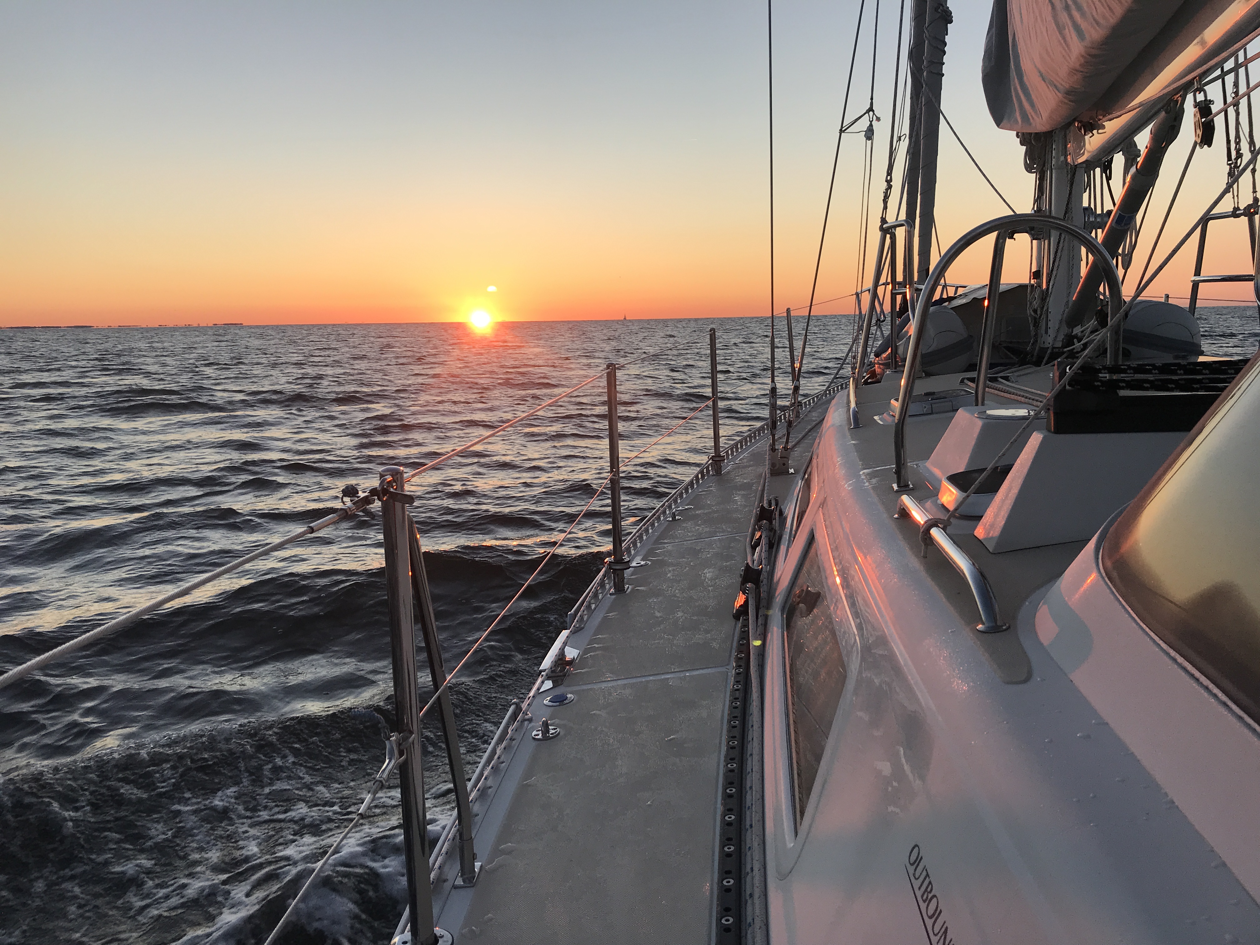
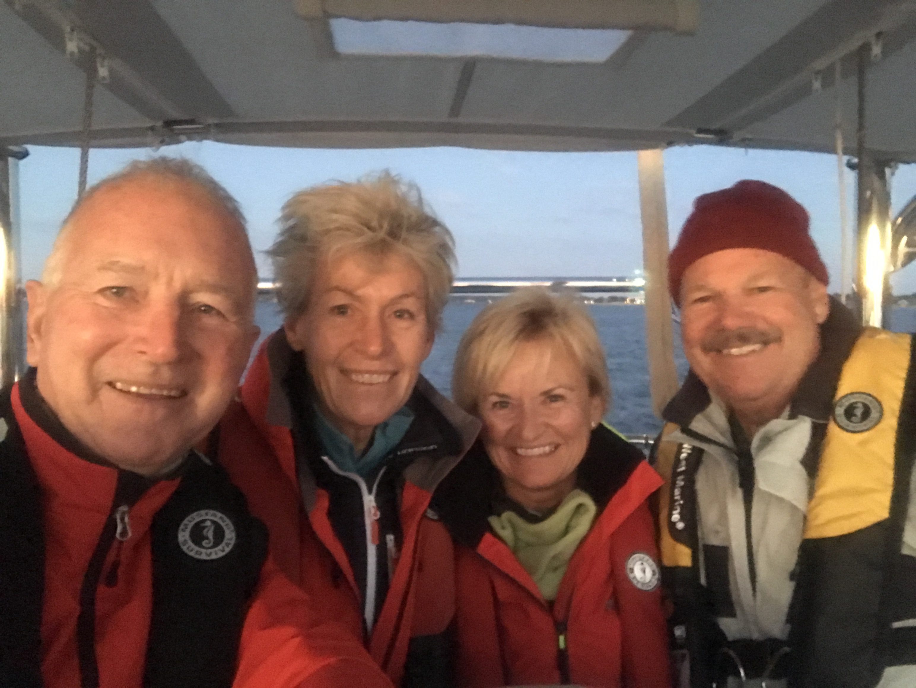
Sunrise departure from Solomons
This year’s passage was somewhat different, in that we simply had no weather window to allow a straight-thru-from-Solomons departure. So we did what many cruisers do – work south, stage, and wait for the window. That meant nearly an additional week, but we were fortunate to have two enthusiastic, talented and flexible crew for the passage. Steve and Teresa flew in from California for the passage, and received a half-day of onboard orientation before retreating to the Holiday Inn for a good night’s sleep. We picked them up at the hotel dock before sunrise on Oct 30th and headed down the Bay as the sun crept above the horizon. We had a great reach sail south to Deltaville, where we made arrangements to stage until the next leg, some 4 days later. Keeping the crew engaged and happy while “waiting for the window” can be a challenge, but this crew was terrific. We spent several hours a day training, lots of time studying weather and talking with our weather router, then free time to explore Deltaville and exercise ashore. Everyone enjoyed the marine museum/sculpture garden, by day and on Halloween night!
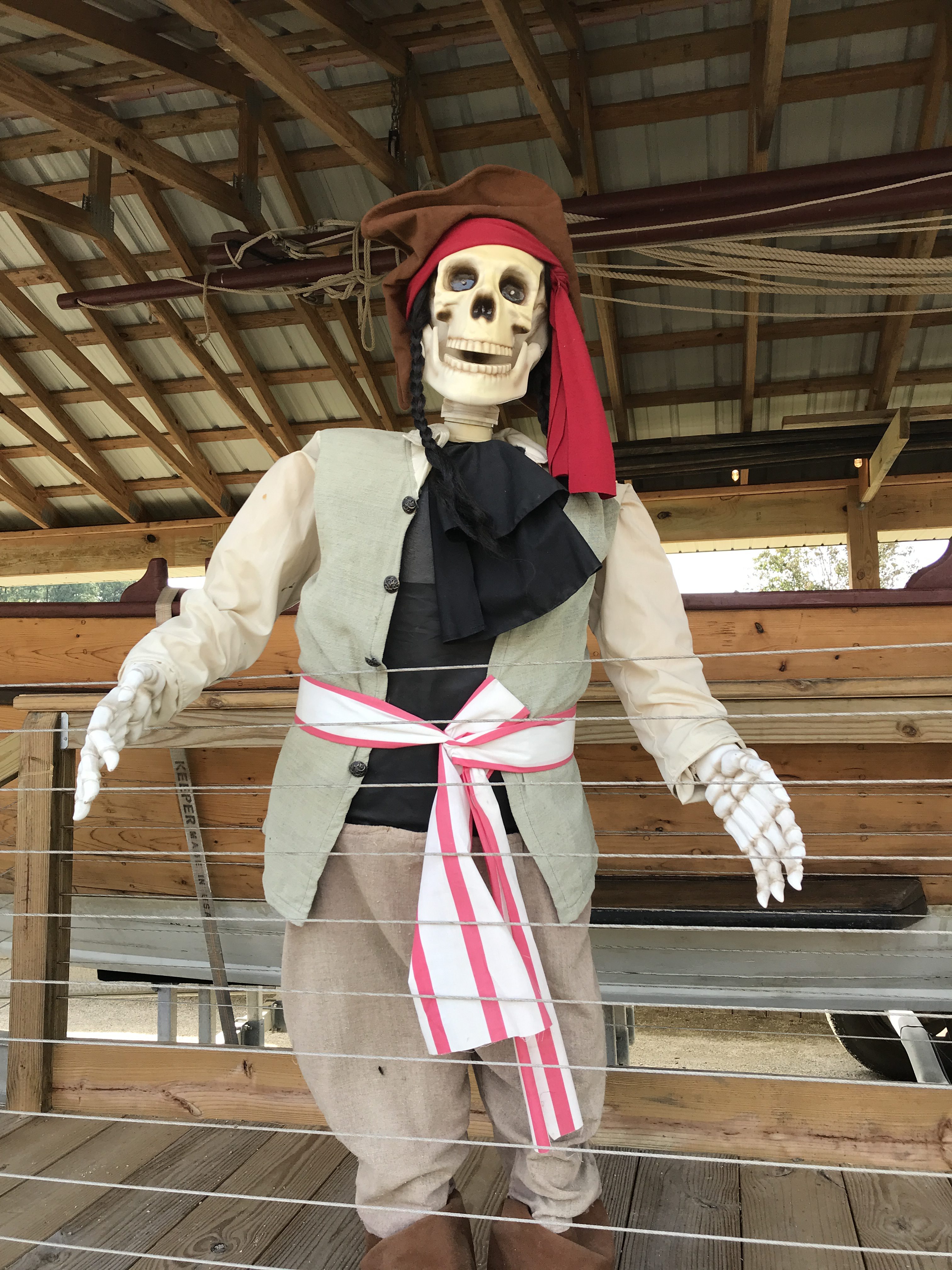
Halloween in Deltaville
The next window to exit the Bay appeared to be 5 November, after a retracting front lifted north of the Norfolk area. On 4 November we sailed south from Deltaville to Little Creek, getting us to the mouth of the Bay while practicing some tacks, gybes and reefing. Several cruising friends (including 2 more Outbounds) were also staged in the Norfolk area, so we had a quick conference call to discuss plans. A final night ashore, and we were more than ready for departure!
As forecast, the front lifted north at noon on Nov 5th, and we headed out of the Bay with a parade of passage-making cruisers awaiting the same window. We motorsailed down the coast towards Cape Hatteras to our recommended Gulf Stream entry point – or as close as the southerly winds would allow us to get to that point. The passage fleet dispersed over the next 12 hours – both visually and from our AIS screen – as several boats opted for a more northerly entry point and high-rpm direct course to Bermuda to stop for crew or fuel.
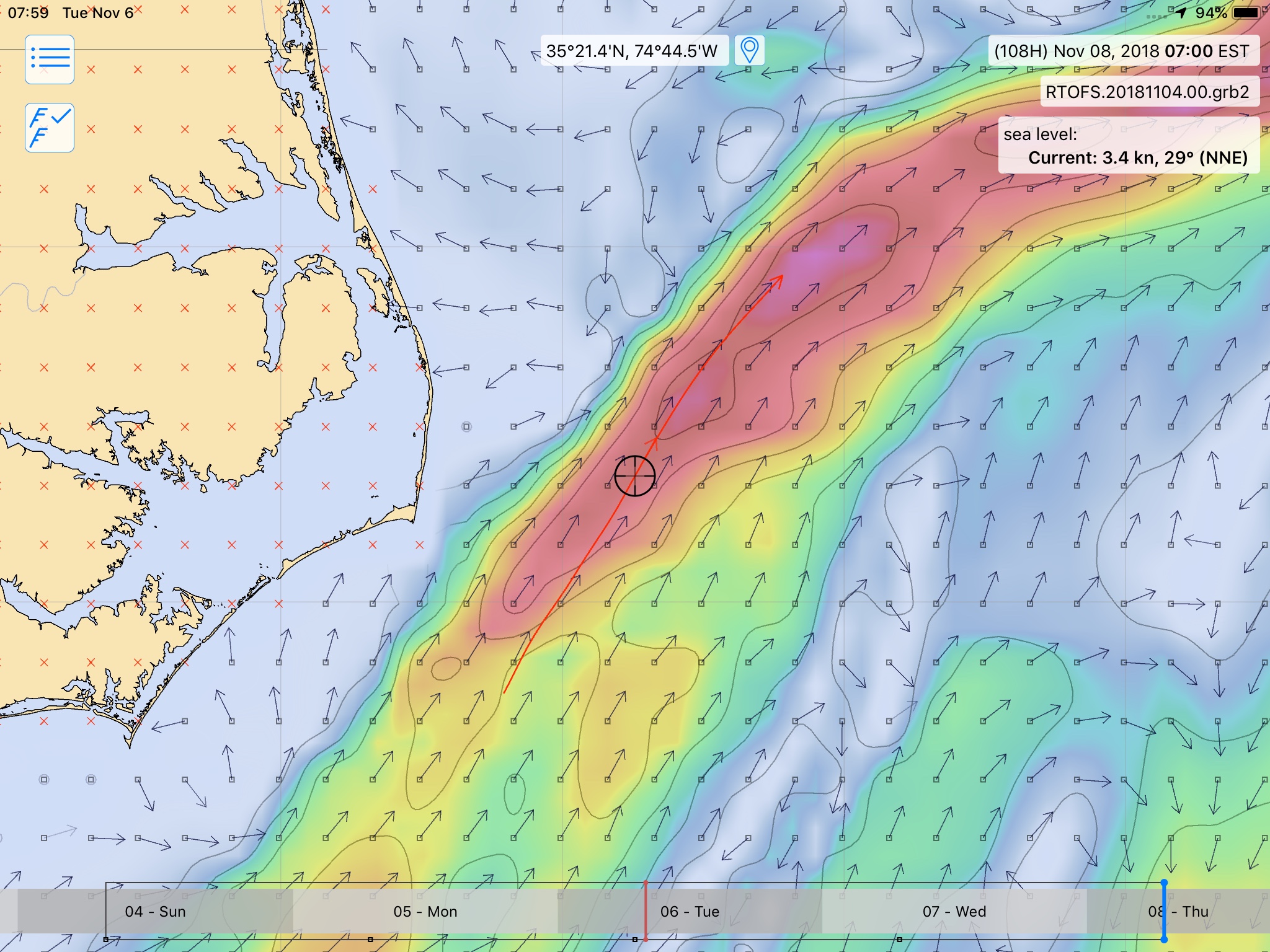
Gulf Stream GRIB
Gulf Stream. We entered the mighty Gulf Stream early morning of Nov 6th. Southwesterly winds at 20 knots quickly built the seas to 6-8’ of nasty chop for the next 10 hours. We tracked our position in the stream by sea temperature, current set & drift, and sea state! This matched well with the GRIB files, and we could easily see our position on the LuckGrib app. The seas settled after we exited the Stream. Winds diminished too, so we progressively shook out the reefs in the mainsail and proceeded with the next phase of the passage.
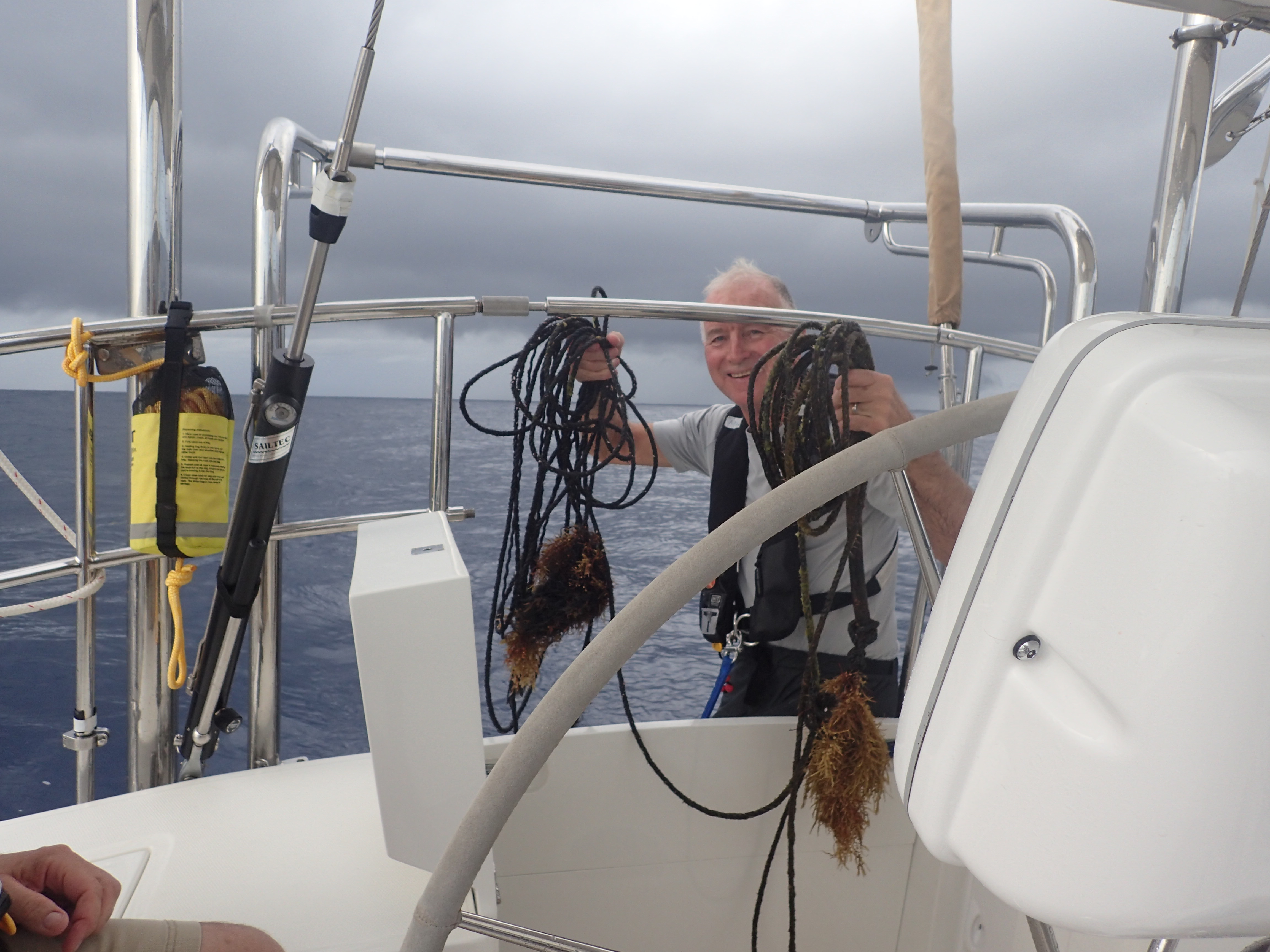
Catch of the Day
Not long after crossing the Stream, Steve noticed a black line trailing from our stern. He and Andy retrieved it “sideways”, pulling some 100’ of thick black polypropylene line on deck. Luckily, it had caught under the rudder, but was not wrapped in the propeller.
Route. Our intent was not a rhumb line but a shaped course – ESE towards Bermuda, continuing our “easting” past St Martin’s longitude (62°W), then south for a reach to St Martin in the tradewinds. Which never quite appear when you want them to, so “easting” is key. Our track line looks wobbly, as we flex the heading with the wind. Quite frequently our autopilot was set on “wind vane” which maintains a constant apparent wind angle, instead of a constant heading. We sailed where the wind would allow us, and made up the difference when we had to
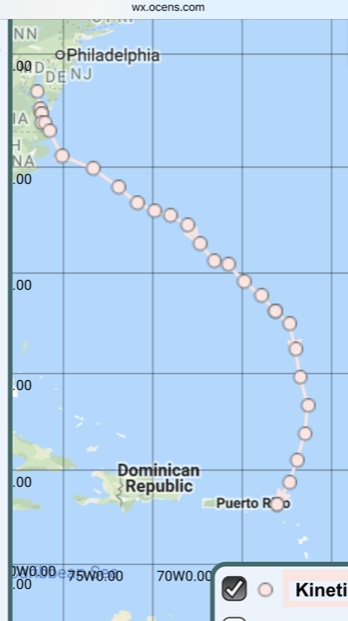
Kinetic’s Track
motorsail. From Nov 8 – 12, our log entries show generally SouthEast headings, but some South, and a rare NorthEast! Using Single Sideband (SSB) radio and sat phone messages, we stayed closely in touch with our weather router, who advised on waypoints and options based on enroute weather. We sent twice-daily position reports via sat phone, keeping family and friends apprised of our progress. (see OCENS track)
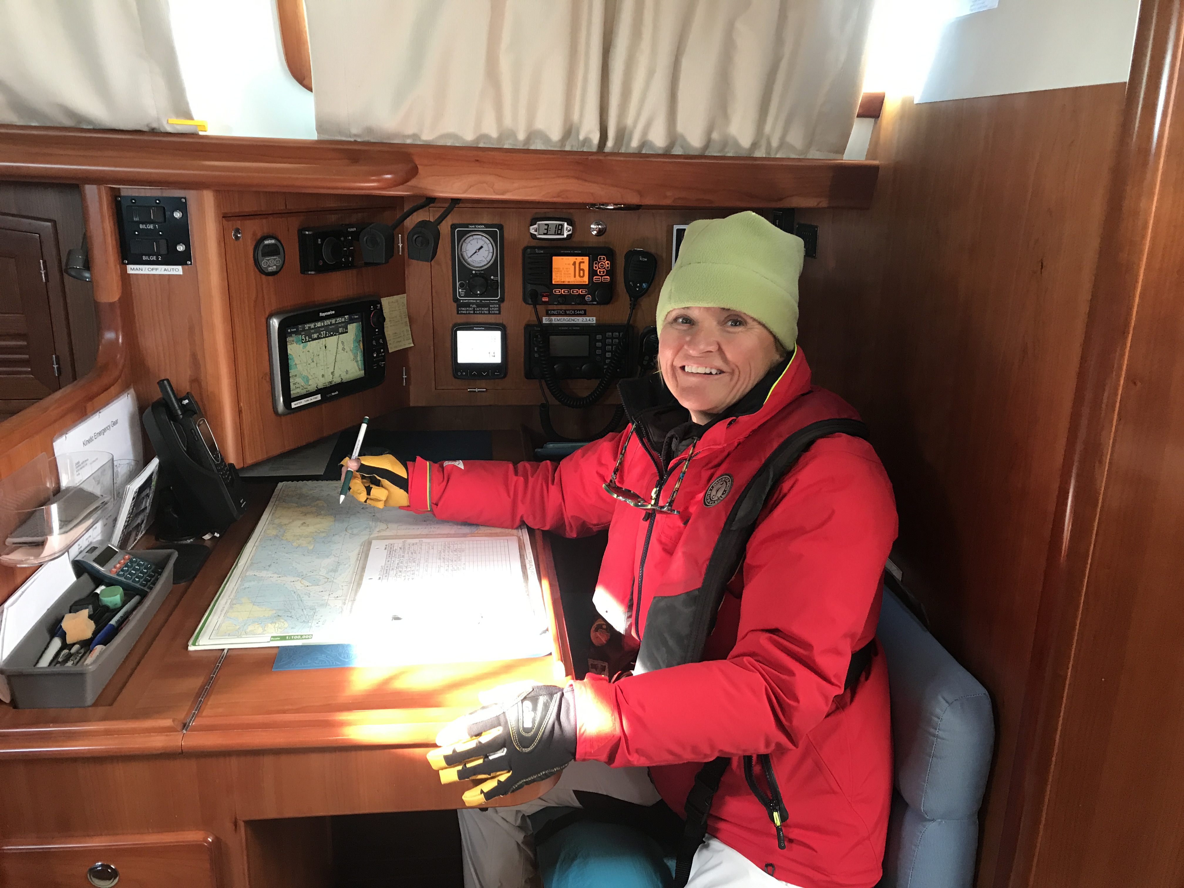
Keeping the log
Watchkeeping. We maintain a watchbill on Kinetic 24/7 on passage, where all crewmembers stand 6 hour watches, followed by 6 hours “off”. Andy and Lisa rotated at 7 and 1 (am and pm), and Steve and Teresa rotated at 10 and 4 (am & pm). This put a fresh person on watch every 3 hours and allowed for more cross-training with watch leads. In addition to our electronic navigation, we maintain a log with entries each hour, and plot our position on paper charts every 3 hours. It takes about 2 days to acclimate to the watch routine, after which everyone was tuned-in, rested, and eating well. Our crew learned to use autopilot, AIS, radar, sat phone, all the electronics, and enjoyed hand-steering Kinetic as well. The daily watch routine involves rig checks, fuel & water monitoring, engineering checks, weather updates, communications, meal prep and housekeeping.
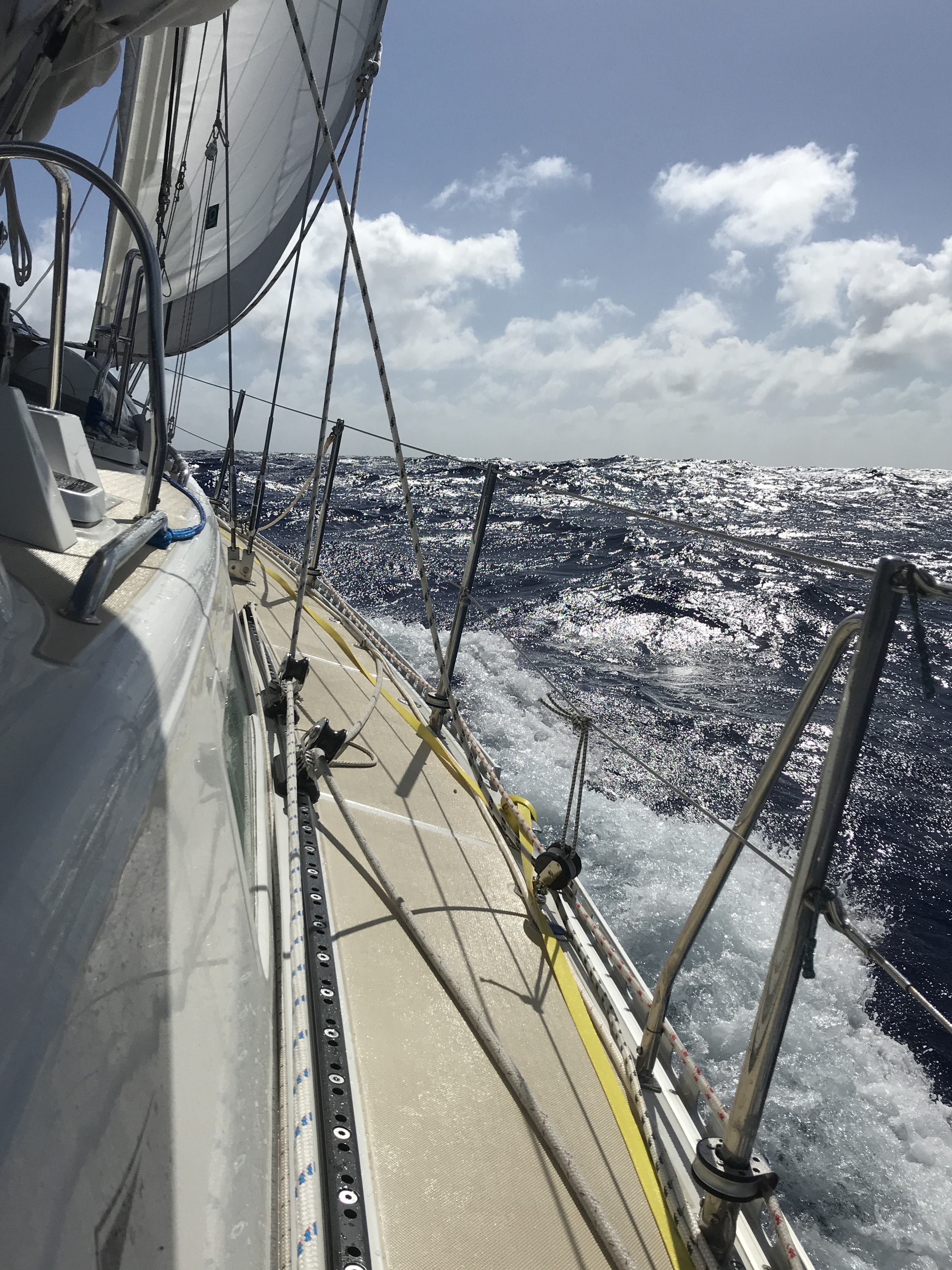
Windward Ho!
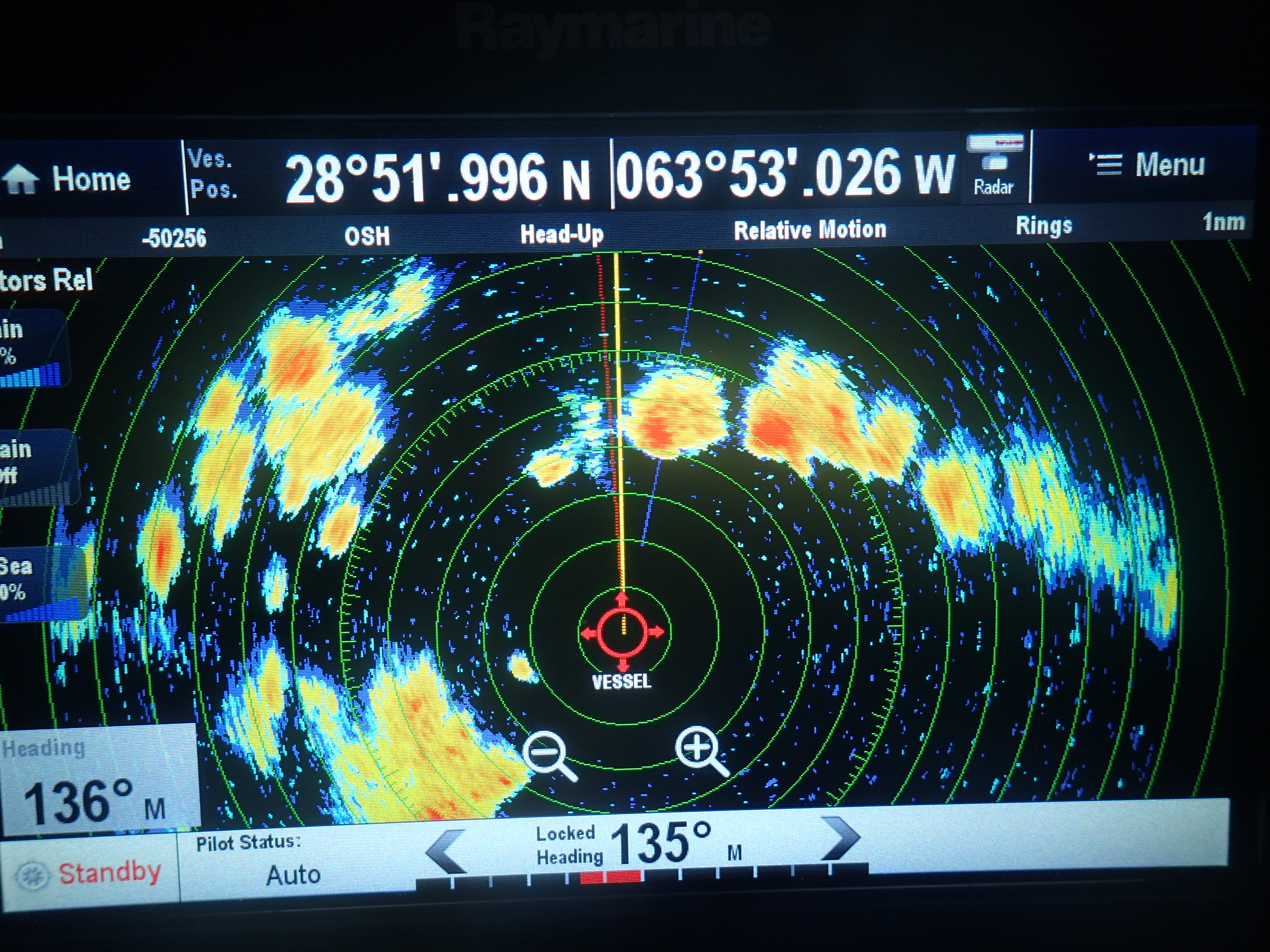
Dodging squalls with radar
By 13 Nov we had attained our easting, and were luckily on the “correct” side of a low pressure trough, which gave us 18-20 knots of easterly winds for the rest of our passage. We flew along at 7-8 kts, negotiating 8-10’ seas with ease. Occasional squalls provided some diversion and a fresh-water rinse, but winds stayed below 30 kts throughout. We adjusted the watchbill so that Steve and Teresa could stand watch together, taking a greater role in decision-making and running the vessel. The plan worked well until our final night, when a rogue wave washed through the cockpit and found it’s way into the crew cabin, soaking the bedding and changing the sleeping/watch arrangements.
Safe Arrival in St Martin!
Land Ho! In the wee hours of 16 Nov we sighted the lights of Anguilla, lying just north of St Martin. We furled the headsail to slow the boat for a daylight arrival, and arrived in the Anguilla/St Martin channel at dawn, in heavy rain. By 8 am, we were safely moored in the lee of Isle Tintemare, off the NE coast of St Martin. The crew celebrated with a hearty breakfast, swim and a day of R&R. The next day we enjoyed a downwind “glory sail” along the coast of St Martin before making our way into Marina Fort Louis and arrival formalities. Steve and Teresa departed for a few days at a St Martin resort before returning to California, while Lisa and Andy began transforming Kinetic from passagemaking to cruising mode.
Stats. A sporty but excellent passage, all in all. 1673 nm from Solomons to St Martin. 1567 nm from Little Creek, and all of it to windward. Kinetic averaged 6 kts over our 11 days of passage, including our economy-rpm motorsailing. We motored more than we’d like, but burned only 83 of our 185 gallons of diesel. More importantly, we arrived safely, with lots of learning, and strong friendships forged in the shared experience.