Blog

Kinetic launched for the season!

Splash!  After a winter on the hard, Kinetic was launched on April 6th to begin the 2016 sailing season. We’re busy with spring commissioning, shakedown, new bimini, and installation of a wind generator.  Kinetic will be displayed at the Annapolis Spring Sailboat Show Apr 22-24 for Outbound Yachts – come see us there!P1050870

IMG_2721

P1050892

Read more

Annapolis Spring Sailboat Show 2016

BoatShowSwing into spring sailing at the the 5th annual Annapolis Spring Sailboat show! Come see Kinetic Sailing onboard our Outbound 46 “Kinetic” at the Outbound Yachts dockside booth!

Hosted by United States Yacht Shows, whose sailboat shows have become the gold standard – coming to you this spring, April 22-24, 2016. This show will feature over 2000′ of floating docks accommodating more than 80 sailboats, plus sailing schools, equipment and accessory vendors, good food, drink and music!  

Details of the show at: Annapolis Spring Sailboat Show.

Read more

Outstanding Instructors for 2014

Instructor Training

Sail Solomons co-owners and instructors Andy Batchelor and Lisa Batchelor Frailey were each named “Outstanding Instructor for 2014”, an award that recognizes the top 1% of over 2000 ASA sailing instructors.

Sail Solomons Sailing School opened in 2007, and has received the Outstanding School award every year from 2008 through 2012, when the award was discontinued. Their instructors have been awarded “Outstanding Instructor” each year since 2007, making Sail Solomons the most recognized sailing school on the Chesapeake Bay.  Lisa notes “We’re more than just a sailing school. We believe sailing is a lifestyle, and we offer a continuum of sailing activities for all levels – from summer on the Chesapeake to winter flotillas and courses in the Caribbean.”

Andy indicates that the success of Sail Solomons is largely due to the small class size and personal attention each student receives. “We strive to give our students an exceptional sailing experience. Our boats are well maintained, and our instructors are all USCG licensed Captains and ASA-certified instructors. We want our students to love sailing as much as we do.” Lisa notes “We thank all our students for taking time to complete the surveys. We try hard to accommodate each student’s learning preferences, and we’re pleased that our efforts have been recognized. Seeing our students enjoy sailing is our greatest reward.”

The school is located at Zahniser’s Yachting Center in Solomons Maryland. Sail Solomons offers courses on their fleet of five daysailers and three cruising yachts for all sailing levels, from novice to advanced. Private instruction is also available. On Your Own Boat courses are very popular for sailors wishing to develop more expertise in specific areas on their own sailboats. Andy and Lisa are now owners of Kinetic Sailing.  They continue to instruct ASA courses for Sail Solomons, which is now under new ownership.

Read more

Hurricane Tips for the Weather-Wise Mariner

By Capt Lisa Batchelor Frailey

Hurricane season is upon us, and it portends to be an active one.  With so many sources of information available, it’s easy to get overloaded by the variety of data and media hype. Here are some definitions and tips to weed out the key information and keep you prepared.

Definitions – adapted from National Hurricane Center’s Glossary:

Tropical cyclone – a rotating, organized system of clouds and thunderstorms that originates over tropical or subtropical waters and has a closed low-level circulation. TC’s rotate counterclockwise in the Northern Hemisphere. They are further classified as:

  • Tropical Depression:  maximum sustained surface wind speed of 33 knots or less.
  • Tropical Storm:  max sustained winds of 34 to 63 knots. Tropical Storms are assigned names.
  • Hurricane: max sustained winds 64 knots or higher. In the western North Pacific, hurricanes are called typhoons; similar storms in the Indian Ocean and South Pacific Ocean are called cyclones.
  • Major Hurricane: A tropical cyclone with maximum sustained winds of 96 knots or higher, corresponding to a Category 3, 4 or 5 on the Saffir-Simpson Hurricane Wind Scale.

Storm Surge – An abnormal rise in sea level accompanying a hurricane or other intense storm. (Storm surge is generally the most dangerous aspect of a storm for mariners in port, causing the greatest damage to life and property)

National Hurricane Center (NHC) is the primary source of hurricane forecasts for the US.  The information is distributed in various formats – text, graphic, voice – to reach all users.  Commercial organizations use the same base layer of information, but use value-added graphics and discussions. The combination can be confusing, so look carefully!

Weather Underground Graphic of Hurricane Irene, Aug 2011

Weather Underground Graphic of Hurricane Irene, Aug 2011

Size Matters – a hurricane’s size is important because of the area it impacts, but its strength (intensity of wind speed) and track are even more important.  Things to look for in the graphics:

  • Forecast track – most probable track of the storm’s center, based on models and meteorologists assessment.  
  • Radius of possible storm center locations (measure of track uncertainty)
  • Radius of damaging winds, where the strongest winds are nearest the storm center, and on the right leading quadrant (as the storm travels). 
  • Wind Speed Probabilities – given for TS strength, 50 kt, and Hurricane strength, by geographic area.
  • Storm Surge – depicted in feet above predicted astronomical tides along coastal regions.
  • Mariner’s 1-2-3 Rule – refers to the rounded long-term NHC forecast errors of 100-200-300 nautical miles at 24-48-72 hours, respectively. It’s a graphical depiction the forecast uncertainty

Understanding these factors of a hurricane forecast will help you keep a sharp weather eye, so you can prepare appropriately. 

Read more

Chesapeake Bay Dreaming

by Captain Lisa Batchelor Frailey

Immortalized by writers, naturalists and artists, the Chesapeake Bay is America’s ultimate cruising destination.  Explorer Captain John Smith described it as “a faire bay encompassed but for the mouth with fruitful and delightsome land” when he created the first maps of the Chesapeake in 1608. A visit to the Chesapeake includes history, beautiful scenery, wildlife and plenty of action.

Origins and History

The Chesapeake Bay formed over 10,000 years ago when melting glaciers effectively “drowned” the Susquehanna River valley. It is the largest estuary in North America, extending 200 miles from Havre de Grace MD to Virginia Beach VA, and measuring 30 miles across at its widest.  Its 11,600 miles of shoreline exceed that of the entire US West coast – a gunkholer’s dream come true.

Chesapeake Bay is steeped in history, perhaps best captured in James Michener’s epic novel “Chesapeake.” The Chesapeake and most of the rivers feeding it carry names from the original Native American residents. English colonists seeking land and opportunity arrived in the Chesapeake region during the early 1600s.

Many towns along the Chesapeake played crucial roles in the War of Independence, the War of 1812 and the American Civil War. Privateers and pirates (including William Kidd and Edward Teach / Blackbeard) also played a big role in shaping the Bay.

Visitors can step back in time and explore the nation’s history in many museums and historic settlements throughout the Bay. Shoreline villages still host shipwrights, crab shanties, bascule bridges and scenic lighthouses. Classic oyster skipjacks, crab scrapers and oyster tongers ply the Bay as they did a century ago.

Seafood Nirvana

The Bay’s estuarine nature (the combination of tidal waters and freshwater influx) makes seafood fresh and plentiful; over 500 million pounds of seafood are harvested each year.  Savor the best crab dishes ever in the Chesapeake – known as the blue crab capital of the world. Try your hand at “chicken-necking” and catch crabs from your sailboat! Oysters are one of the Bay’s most valuable commercial fisheries, and you’ll find oysters served every way imaginable.  Another favorite is Rockfish – not only excellent sport for recreational and commercial fishermen, but also great eating.

Planning your Sail

You can reach the Chesapeake Bay by plane, train, car or boat.  Baltimore’s airport and rail station are most convenient for the northern reaches, and Norfolk for those starting south. Cruisers enter the Bay through the Chesapeake & Delaware Canal, or from the Atlantic at Cape Henry. The predominance of bareboat charter companies is located in Annapolis, but you’ll find ASA sailing schools and charter bases along the 200 mile length of the Bay. This distribution is ideal, as the Bay’s size and variety allows you to explore on many visits without ever repeating a destination.

Most charter bases operate from mid-April through October. While mid-summer weather is typically hot and humid, you’ll find good sailing winds throughout the season. Early Summer and Fall are favorites, and holiday weekends are in high demand. Prevailing winds are not distinct, but Southerly to Westerly winds are most common in the summer, heavily modified by sea breeze and local topography. Thunderstorms can be wild, so be sure to keep a weather eye and plan accordingly. Tides and currents are easy to manage, since the tidal range for most of the Bay is only about 1.5 feet.

Provisioning is simple; most charter bases have well-stocked grocery stores nearby. Be sure to plan for a few meals ashore to experience the local flavors and specialties.  Fuel, water, ice and pumpout stations are conveniently located throughout the Bay. Sailors can berth in marinas ranging from luxury resort to “mom ‘n pop”, anchorages or moorings in major harbors with water taxis, or secluded anchorages where herons are your closest companions.

Notable Cruising Destinations

The Chesapeake offers remote, unspoiled beauty in close proximity to cosmopolitan city centers. The variety is so diverse that it’s impossible to capture it all in a lifetime of cruising, much less to describe it in a single article. From north to south, here is a sampling of notable destinations to whet your appetite.

* Sail the Patapsco River into Baltimore Inner Harbor, featuring museums, shopping, dining, arts and major league sports in a waterfront urban setting.

* On the Eastern Shore, Rock Hall features the annual “Pirates and Wenches Fantasy Weekend”.

* Annapolis visitors can enjoy a bustling port town, state capital and the home of the US Naval Academy. Known for the National Sailing Hall of Fame and US Sailboat shows, Annapolis features the largest selection of bareboat charter yachts on the Chesapeake.

* “The Town that Fooled the British”, St Michaels is one of the most charming colonial towns on the Bay’s Eastern Shore. Visit the Chesapeake Bay Maritime Museum and wander the brick-paved sidewalks to browse shops and galleries.

* Glide through the bascule bridge at Kent Narrows, lined with workboats and skipjacks. Continue up the Choptank River to find abundant snug anchorages off the meandering tributaries of Broad Creek. Watch soaring osprey dive for fish, and keep your eyes open for celebrity estates!

* From the Choptank, follow the Tred Avon to the beautiful waterfront town of Oxford.  Marinas and restaurants nestle among tree-lined streets; don’t miss the iconic Cutts & Case Shipyard. If Oxford seems familiar, perhaps you’ve seen one of the many films set there.

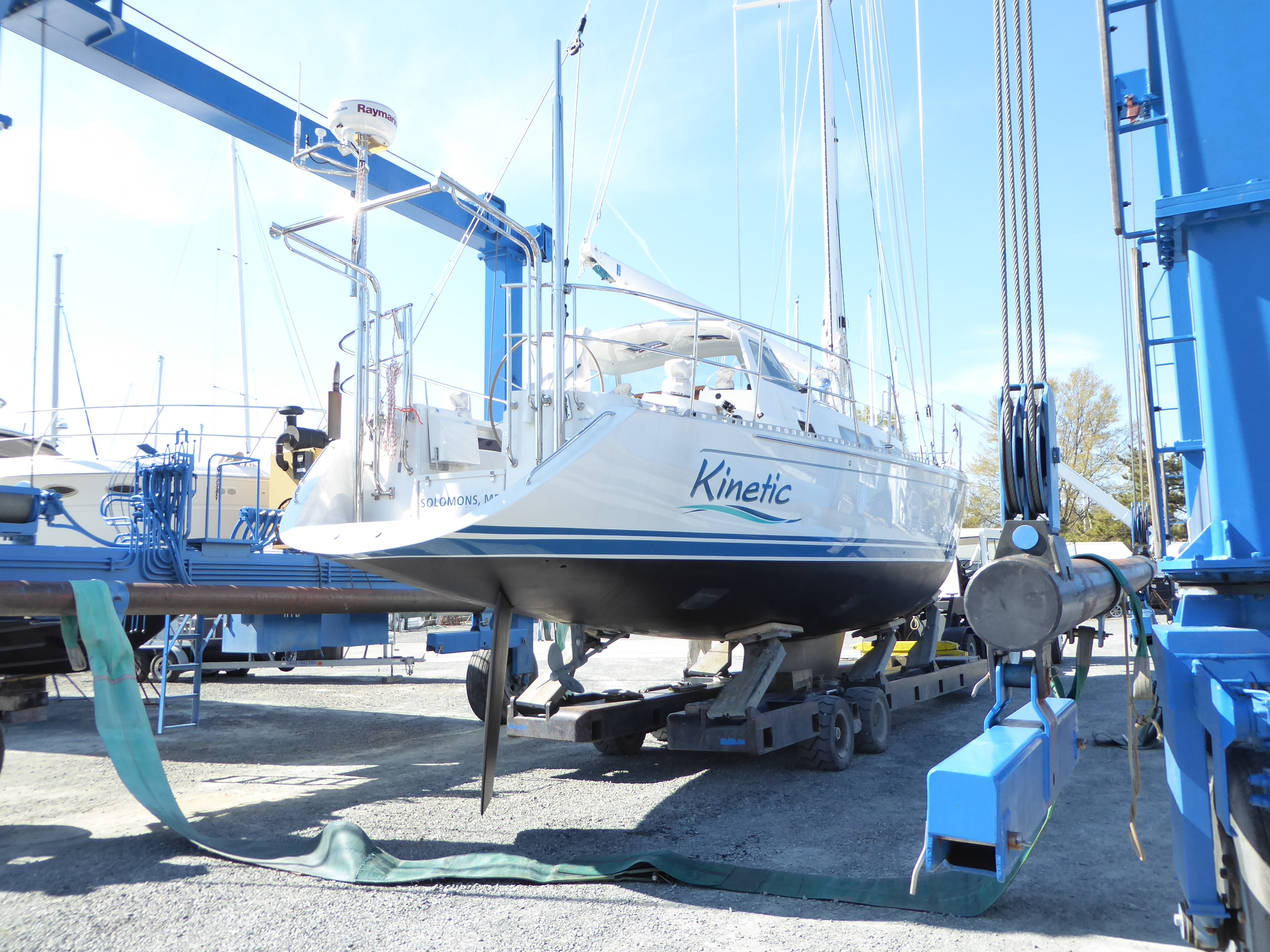
* At the mouth of the Patuxent River, Solomons offers sailors a host of fine marinas and the world-famous Tiki Bar. Climb the Drum Point Screwpile lighthouse, take a cruise on a Skipjack, or wander through a sculpture garden featuring works from the Smithsonian.

* Enjoy a pile of steamed crabs in Crisfield, the “Crab Capital of the World”. Crisfield’s National Hard Crab Derby features feisty crabs racing on a track, and the largest boat-docking completion on the Chesapeake. Nearby Deal Island hosts the annual Skipjack race.

* Step back in time on Tangier Island, one of two island communities of watermen in the Chesapeake. You’ll hear a relic Elizabethan dialect still intact from the island’s original Cornish settlers. Distinctive crab shanties line the channel to the harbor; bikes and golf carts are the principal transportation ashore.

From cosmopolitan Baltimore to the time capsule of Tangier, the Chesapeake Bay is a cruiser’s dream. Capt John Smith’s words still ring true: “heaven and earth never agreed better to frame a place for man’s habitation.” Or, man’s sailing!

Read more

Destination: Solomons for Screwpile!

by Lisa Batchelor Frailey

Securely berthed on a tee-head in Solomons, Maryland, you savor a mug of fresh-brewed coffee in the cockpit of your well-appointed bareboat charter yacht. You relax in the sunny warmth while you plan your day’s sail on the Chesapeake Bay. Suddenly, a blast of music breaks your reverie, and you watch in awe as a hundred race boats parade past you –  battle flags flying – headed for the Patuxent River. It’s Screwpile in Solomons!

The Screwpile Lighthouse Challenge is a regional sailboat regatta, drawing over 120 boats (and their crews and enthusiastic supporters) each year from across the country. The event features three days of round-the-buoys racing and three nights of rip-roaring parties. A point-to-point race from Annapolis to Solomons on Friday night, July 19th, brings many of the fleet contenders to town. After a Saturday of rest, relaxation and rum, this year’s Screwpile begins on Sunday, July 21 and ends on Tuesday, July 23. One-design and PHRF classes compete three races per day across courses set at the mouth of the Patuxent. Each morning features a 9 am Harbor-Start parade, and camaraderie prevails at the post-race parties hosted at the waterfront Solomons Holiday Inn.

Screwpile has been a Solomons institution since 1993, when the Southern Maryland Sailing Association (SMSA) took over the efforts of the (departed) Yachting Magazine Race Week.  The regatta is named for the screwpile-style lighthouse that once guarded the mouth of the Patuxent at Drum Point, and now stands proudly at the Calvert Marine Museum.

Whether you’re racing Screwpile, cruising the Bay or exploring by car, Solomons is a fabulous place to visit. This historic maritime community was recently named one of America’s “15 Happiest Seaside Towns” by Coastal Living Magazine, and deservedly so. Located just 50 miles south of Annapolis, Solomons is an easy reach for cruisers and bareboat charterers.

Several full-service marinas cater to visiting boaters, offering secure berths, hot showers, restaurants, swimming pools, bicycles and marine services. You’ll also find a sailing school and bareboat charter base (Sail Solomons), as well as fishing tours. Rent a kayak or SUP to explore the harbor from a new perspective. For those who prefer seclusion, snug anchorages are available in Solomons harbor and surrounding creeks. Solomons offers a number of hotels and gracious B&Bs for those not staying onboard.

Most marinas are an easy walk or bike ride from town, which boasts a wealth of activities for visitors. At the Calvert Marine Museum, visitors can explore how the prehistoric past, natural environment and maritime heritage blend to tell a unique story of the Chesapeake. Climb through the Drum Point “Screwpile” lighthouse, watch the sea otters at play, and enjoy a river cruise on a historic oyster “buy-boat”. CMM’s waterside concerts include classic favorites like Bad Company and ZZ Top.

Annmarie Sculpture Garden and Arts Center is an oasis for the art lovers. Weave your way along the wooded walking path and feast your eyes on sculpture, including many on loan from the Smithsonian Institution and National Gallery of Art. The ship-inspired Arts Building includes rotating exhibition space, so each visit is a new adventure.

Solomons is home to the University of Maryland’s Chesapeake Biological Laboratory, where visitors can learn about the natural environment of the Chesapeake Bay.  CBL’s location at the mouth of the harbor makes it a perfect spot to watch the Screwpile Harbor-Start parade and returning racers.

Savor a meal at one of the many Solomons waterfront restaurants, featuring fresh local seafood. Stroll along the Riverwalk and enjoy the fabulous view of the Patuxent River. Shoppers will appreciate the galleries, antiques, gift shops and boutiques in the heart of town. A spa treatment is just the thing after a hard day of sailing (or shopping).

Solomons’ summer-time events include a July 4th fireworks extravaganza and boat parade, the Offshore Grand Prix powerboat races, Arts Fest, and Watermen’s Festival.  You may have come for Screwpile, but Solomons offers so much more. Discover the magic of Solomons, and you’ll return again and again.

For more information, see http://www.solomonsmaryland.com/ and http://www.screwpile.net/.


Read more

“Outstanding School & Instructors” for 2012

Sail Solomons has been named “Outstanding School for 2012” by the American Sailing Association (ASA). The award recognizes the top 20 of over 300 ASA sailing schools worldwide, and is based upon responses from 2012 student surveys regarding the quality of service, boats and instruction.

Sail Solomons co-owners and instructors Andy Batchelor and Lisa Batchelor Frailey were each named “Outstanding Instructor for 2012”, an award that recognizes the top 1% of over 2000 ASA sailing instructors.

Sail Solomons Sailing School opened in 2007, and has received the Outstanding School award every year from 2008 through 2012. Their instructors have been awarded each year since 2007, making Sail Solomons the most recognized sailing school on the Chesapeake Bay.  Lisa notes “We’re more than just a sailing school. We believe sailing is a lifestyle, and we offer a continuum of sailing activities for all levels – from summer on the Chesapeake to winter flotillas and courses in the Caribbean.”

Andy indicates that the success of Sail Solomons is largely due to the small class size and personal attention each student receives. “We strive to give our students an exceptional sailing experience. Our boats are well maintained, and our instructors are all USCG licensed Captains and ASA-certified instructors. We want our students to love sailing as much as we do.” Lisa notes “We thank all our students for taking time to complete the surveys. We try hard to accommodate each student’s learning preferences, and we’re pleased that our efforts have been recognized. Seeing our students enjoy sailing is our greatest reward.”

The school is located at Zahniser’s Yachting Center in Solomons Maryland. Sail Solomons offers courses on their fleet of five daysailers and three cruising yachts for all sailing levels, from novice to advanced. Private instruction is also available. On Your Own Boat courses are very popular for sailors wishing to develop more expertise in specific areas on their own sailboats.

Read more

New Chesapeake Bay Charts

By Capt Lisa Batchelor Frailey

Attention all US boaters!  If you’re looking for nautical charts, there’s a whole new game in town – “nv-charts”.   I’ve been using nv-charts’ Caribbean charts for years, and have always been impressed by their practicality, accuracy of data and clarity of presentation.  Whether a chart kit or a waterproof folding chart, nv-charts (formerly marketed as CYC) was an easy choice when cruising Caribbean waters. I met with nv-charts owners Hasko and Connie Scheidt last Fall, and was thrilled to learn that nv-charts has expanded their coverage to US East Coast waters. They released the Chesapeake Bay regions –  just in time for the 2012 boating season.  I showed my first set to our dock neighbors and sailing students who really loved the product; now I can barely keep them in stock!  Read on to see why nv-charts are the hottest items of the season.

The Chesapeake Bay series is divided into two regions, North and South, for easy handling.  The North region (5.1) includes Delaware Bay and the C&D Canal, and covers from Cape May, NJ to the Potomac River. The South region (5.2) overlaps at the Patuxent, and continues in detail from the Potomac down to Norfolk, including Tangier Sound and the Delmarva coast.  Together, the region provides all the coverage you need for cruising the Chesapeake or Delaware Bays and a Delmarva circumnavigation.

What’s included:   The spiral-bound chart books are 23.5” x 16.5”, designed to fit conveniently on most chart tables, and protected with a clear vinyl waterproof cover.  Each chart set comes with a Harbor & Anchorage Pilot Book with comprehensive navigation and cruising information and regional descriptions, weather and tide information, cruising destinations, harbors, moorings, and anchorages from entries referenced on the charts. Each chart set also includes a CD containing the entire chart set in digital format, for use on PCs with navigation software and GPS input. Free navigation software is available to download from the nv-charts website.

Key Features. At first glance, you’ll notice some differences between nv-charts presentation and that used by NOAA and commercial competitors. With a little examination, you’ll find the nv-charts presentation to be more intuitive than other charts; regardless, a complete and easily understood legend is included in the pilot book.  Key features of the nv-charts US charts and pilot books:

  • Charts are based on NOAA data with a new layout, clear cartography and international chart standards using WGS-84 datum;
  • Seaworthy chart layout – easy flow from one chart to the next;
  • Standardized chart scales:  passage charts 1:340,000;  coastal charts 1:100,000 and 1:45,000;  detail charts 1:25,000 or less;
  • Pre-plotted GPS lat/lon waypoints; tracks and distances between waypoints for easy planning
  • Depths and heights are charted in feet; referenced to MLLW and MHW, respectively
  • Unique color differences:  dark blue less than 18’ deep, light blue 18-30’ deep, green for exposed tidal areas;
  • Contour lines for 6’ (red), 12’ and 30’ depths;
  • Channel markers (day shapes and lighted markers) are depicted in red and green; buoys have realistic symbology
  • Arrow-symbols show buoyage direction;
  • Enhanced Lighthouse symbology  for better identification and light characteristics;
  • Illustrations of lighthouses (sea level view) are depicted on the chart margin
  • Tide and current information depicted on each chart, where data is available.
  • Grocery,  Marine Services and West Marine stores  indicated for convenience


Who is nv-charts?  This global supplier of precision charting products began producing navigation charts over 30 years ago in Germany, and their charts are used by cruisers, racers, the US Coast Guard  (for Bahamas and Caribbean) and the Baltic-Kiel-Pilots.  nv-charts’ parent company is Nautical Publications, with offices in Newport and Germany. They produce about 600 charts and over 1000 details & harbor plans, derived from government data and  confirmed and/or revised through nv-charts’ own survey vessels and aerial images. nv-charts now offers charting products for the U.S. East Coast from New England to Key West, Europe, the Bahamas, Puerto Rico and the entire Caribbean, including Cuba.

Where can you get nv-charts?  At Sail Solomons, of course!  Call Lisa at 410-326-4917 or email info@sailsibackup to order.  For best value and more diverse cruising options, buy the Chesapeake Bay Box set including both North and South regions.  Happy Cruising!

Read more

Winter Courses for Sailors & Powerboaters

What skills benefit sailors and powerboaters alike? Weather and Navigation!

These 4-day courses are applicable for both sailors and power-boaters, and there are no pre-requisites. Price per course is $395, and includes books and certification materials. Register now to reserve your spot; you’ll get your course materials early so you can get started! Call 410-326-4917 or email info@sailsibackup

Marine Weather Sailing CourseMarine Weather Sailing Course

Take the mystery out of marine weather forecasts; understand the principles, learn how to apply the information for local and passage-making voyages. From traditional maritime forecasting skills to the latest technological tools, this course will help make your time on the water as safe and efficient as possible. Taught by a marine meteorologist and sailing passagemaker.

Course: Marine Weather (ASA 119)
Date/Time: Feb 11, 12, 18, 19 from 0900-1600
Location: Zahniser’s Yachting Center, Solomons MD
Cost: $395 (includes text, workbook, certification materials)

Coastal Navigation Sailing CourseCoastal Navigation Sailing Course

Plot your course to success! Learn the theory and skills to safely navigate in coastal or inland waters. Sail Solomons’ 4-day Coastal Navigation course is taught by a retired Navy navigator and ocean passagemaker.

Course: Coastal Navigation (ASA 105)
Date/Time: Mar 3, 4, 17, 18 from 0900-1600
Location: Zahniser’s Yachting Center, Solomons MD
Cost: $395 (includes books, charts, certification materials)
Navigation Tools available at Sail Solomons discount
Note: This course is also available by correspondence; cost is $300

Enquire Now

Read more