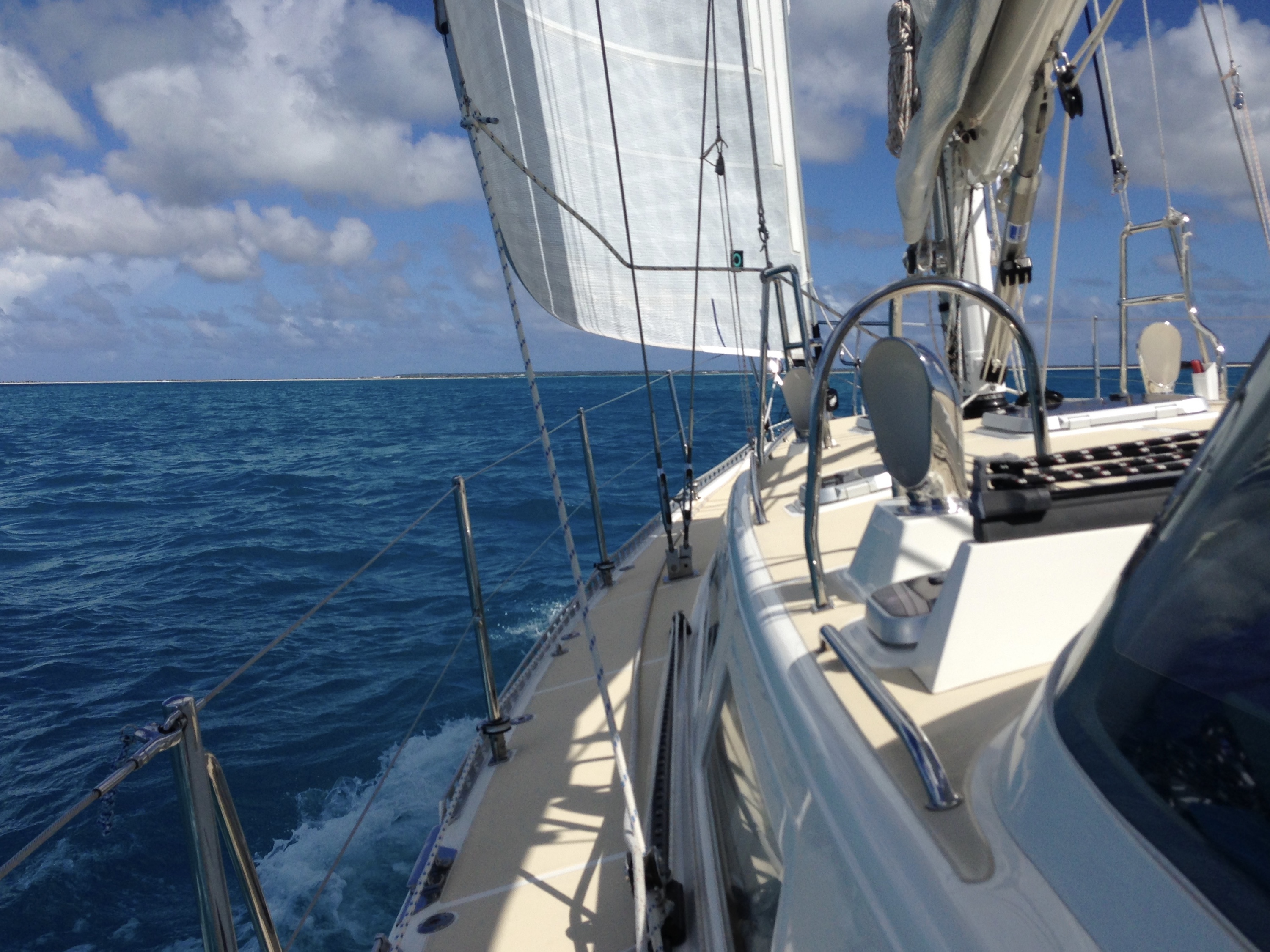
Sailing to Barbuda
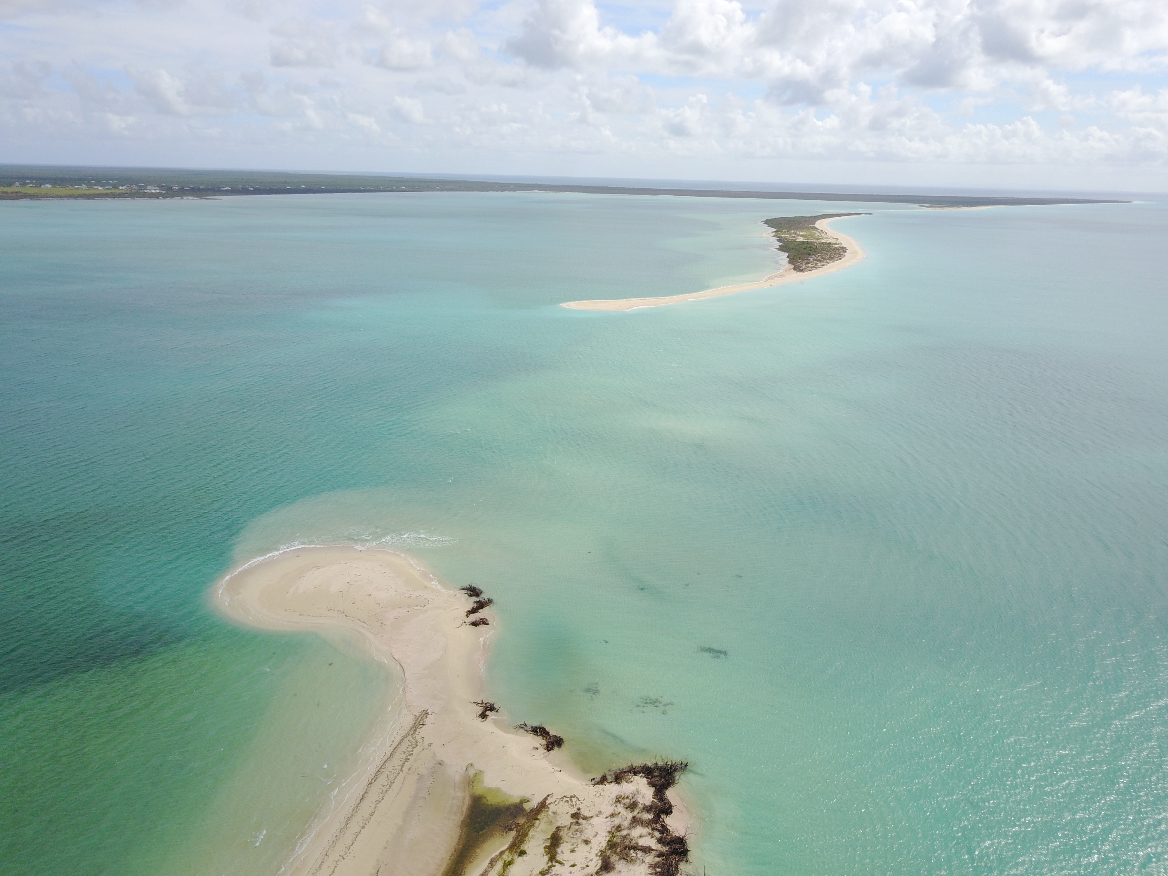
This season we’ve made three trips to Barbuda, the lesser-known half of the nation “Antigua & Barbuda” that lies 30 miles north of Antigua. Low-lying Barbuda was absolutely devastated by Hurricane Irma in September 2017, and the entire population of 1700 residents was evacuated to Antigua. It was the first time that Barbuda was uninhabited since it was originally colonized by the Codrington family in 1685. The Codrington Lagoon, which shelters the 2nd largest frigate bird sanctuary in the world, was breached in two places on its western boundary, allowing direct ocean access into the lagoon. When that much sand moves out, it must be deposited somewhere. We didn’t know how much the undersea bathymetry had changed, and didn’t want to explore new shoals with our keel. After arriving in Antigua in November, I spent 2 weeks trying to make contact with Barbudans and relief organizations, and was finally able to do so via Facebook sites. Our friends on catamaran GEMEAUX sailed up, confirmed some navigation areas, and took extensive drone footage that I was able to share with Barbuda relief agencies and the cruising community.
Local news emphasized the political aspects of the evacuation and repatriation, the “land grab” bill allowing Barbudans to individually purchase the land upon which they lived (Barbudans already own the land communally and don’t want the change) and the legality of expanded development for resorts like the K Club, now leased by Robert DeNiro. Reading the news made us really wonder what we’d find out on the island.
Anchored off Barbuda
Our first visit was on Christmas Day – we sailed from Antigua to Cocoa Point, on the protected south coast of Barbuda. We anchored off the Cocoa Beach Club, an exclusive resort that was in full swing when we visited last year. Now it’s a shambles – palm trees uprooted, roofs ripped off, concrete walls tumbled, pantry supplies scattered cross the grounds. Wild donkeys graze through the mess in search of a meal. Eerily, a few wineglasses and ceramics remain untouched, and someone has artfully arranged them into a macabre setting on the beach. Further west on the beach is the K Club, already in a sad state of disrepair before the hurricane, and now a disaster. Yet behind the grounds we found evidence of bull-dozing for an expanded airport. We spent 2 nights anchored at the once popular Cocoa Point, with only 2 other boats in sight.
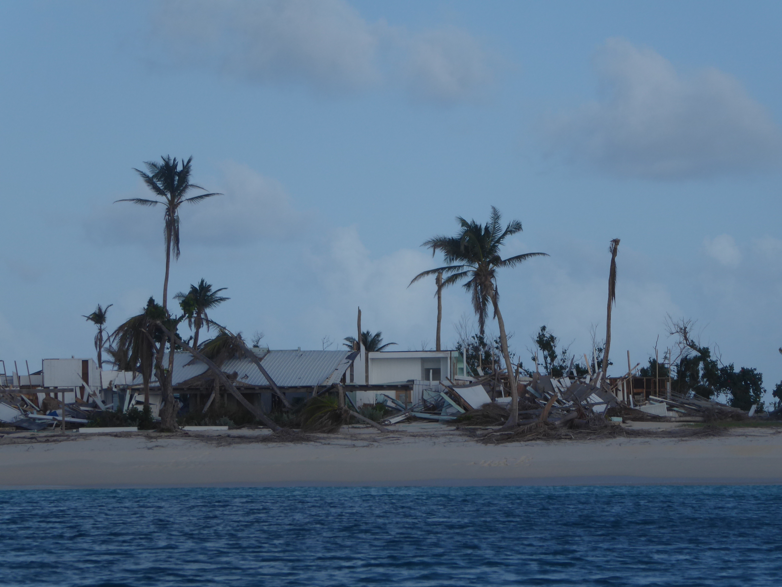
Cocoa Point Beach Club in ruins
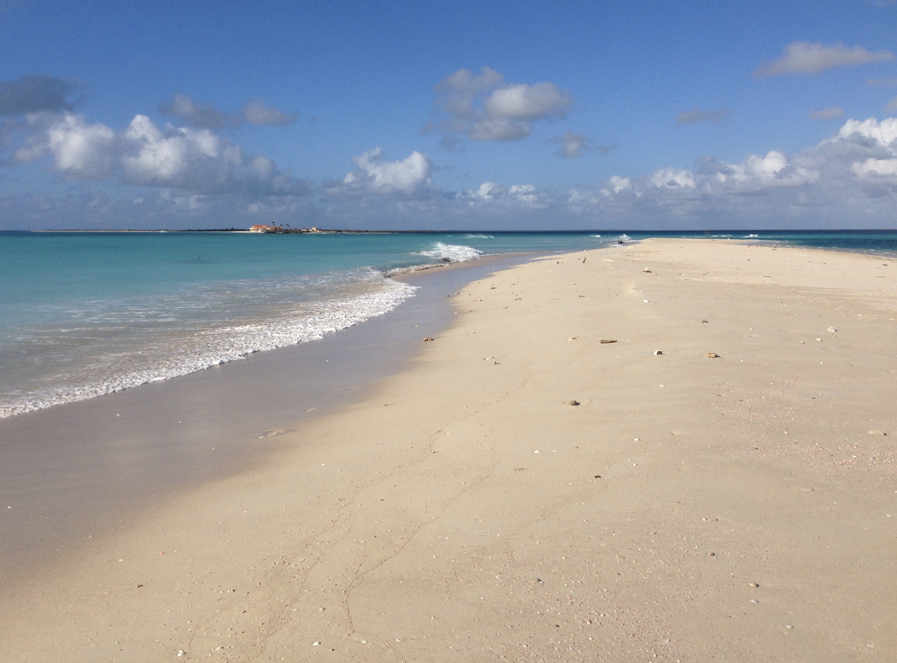
Still Barbudaful
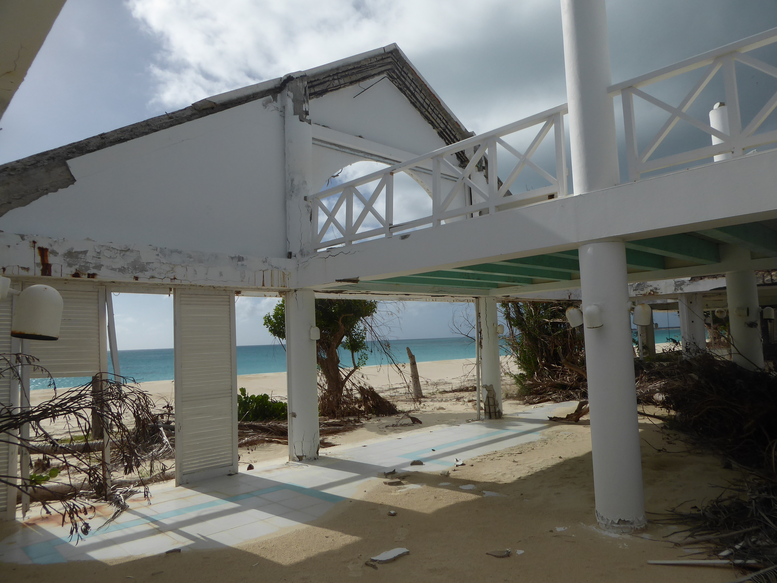
Remants of the K Club – once the playground of the rich and famous
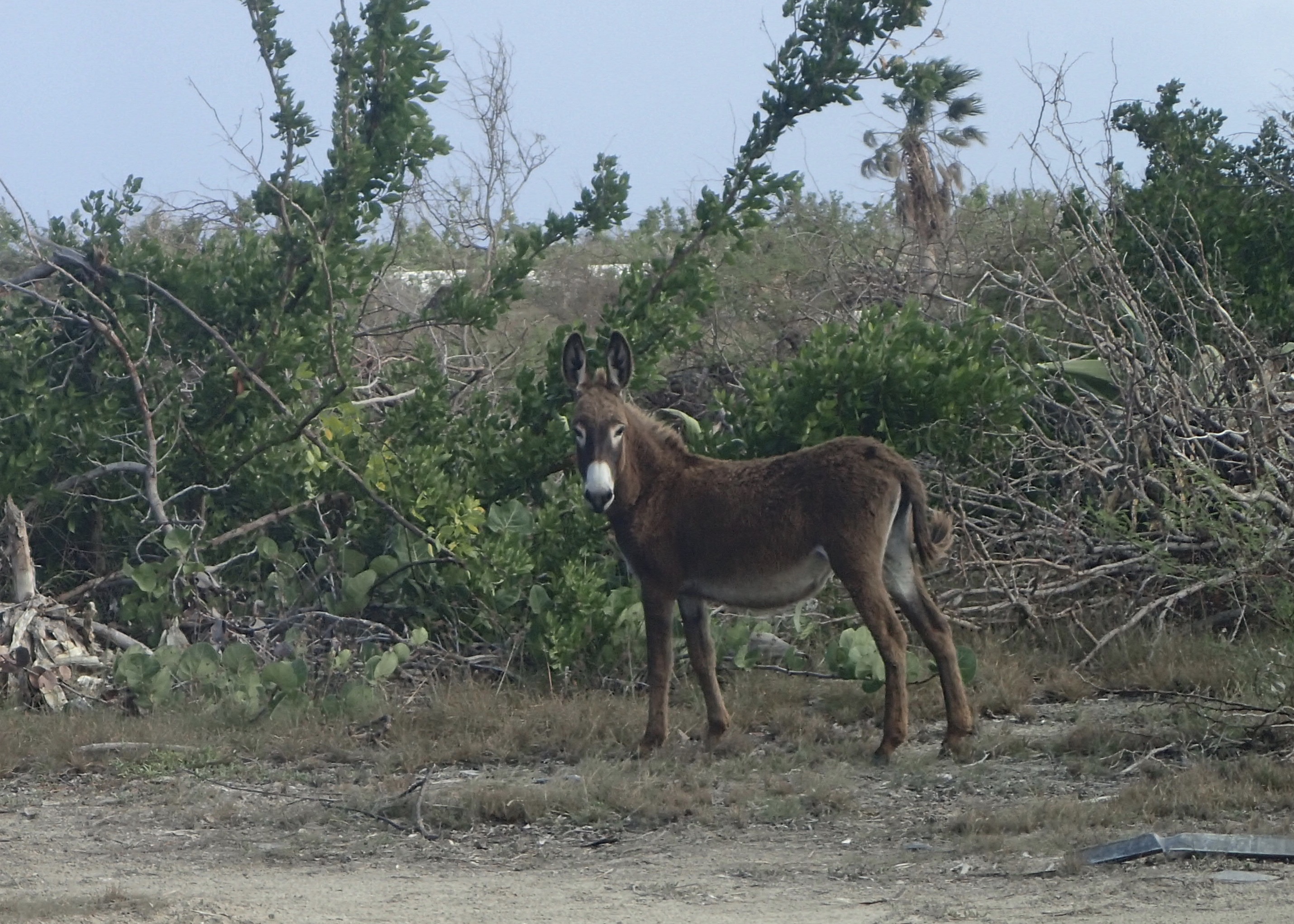
Feral Donkey
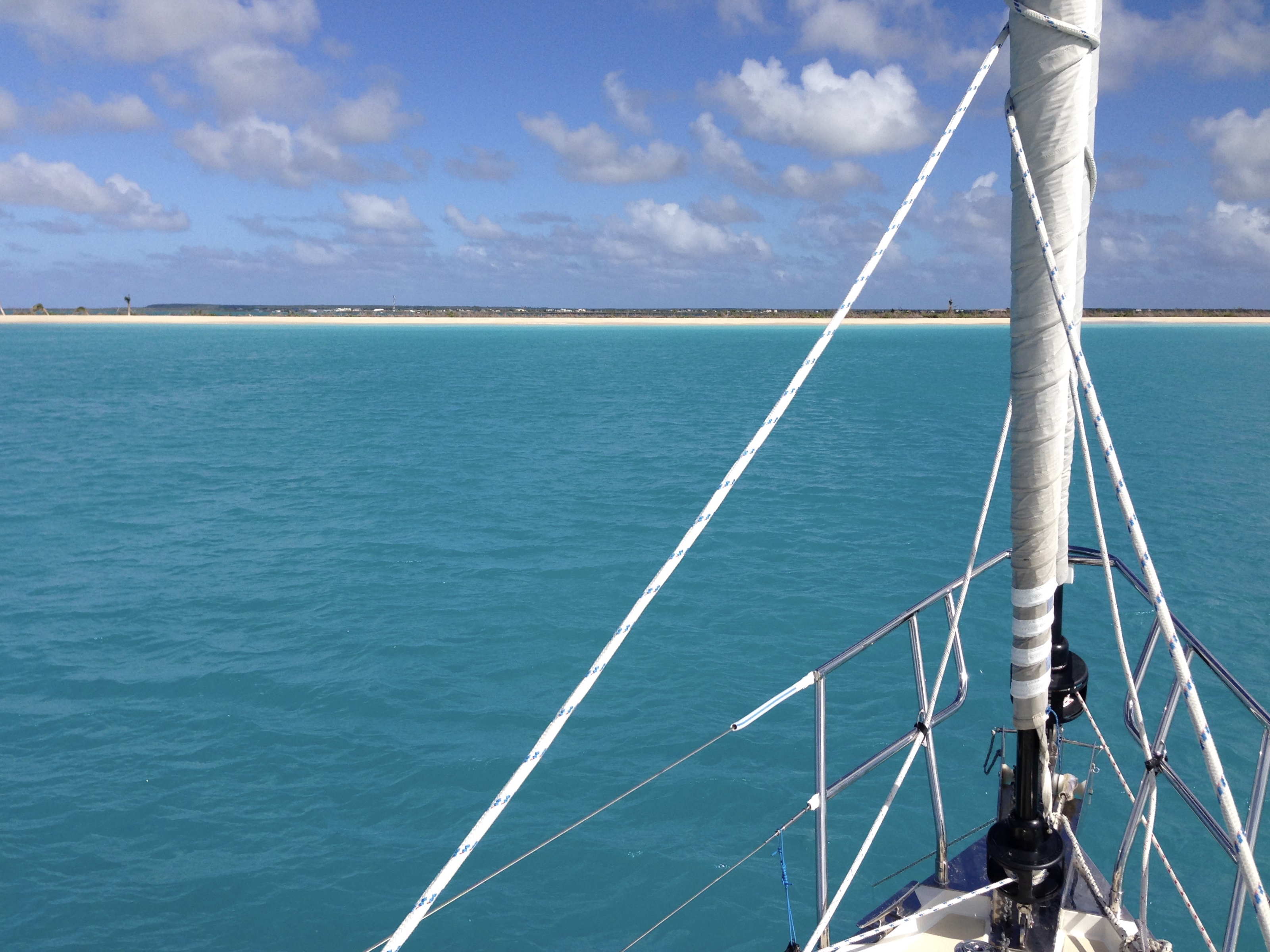
Our second visit was to Low Bay, on the west side of the island. On previous visits, we anchored off Louis Beach at the Barbuda Outback – Jala’s 2-story beach shack – on the pristine, pinky-white 17 mile beach east of Tucson Rock. It was a short walk across the sand spit to the lagoon, where Jala docked his boats for the frigate bird tours. Jala’s beach shack is little more than a hole in the ground now, with evidence of electrical conduit, a propane cylinder and a couple of generators peeking from the sand. His cultivated palm trees are bent over at unnatural angles – yet are still producing coconuts. The 17 mile beach is breached in 2 spots, south and north of Outback, at Donna Mouth and Louis Mouth. These are named for the previous hurricanes (1960 and 1995, respectively) that cut swaths through the beach, creating channels into the lagoon, and were gradually filled by natural processes. Nature repeats itself – we learned that the new cuts are already filling. According to a local captain, what was a 12’ deep cut just after Irma is now a 6’ cut, and filling fast. Lighthouse Bay Resort lies just north of Louis Mouth – abandoned a few years ago, it now looks like a Salvador Dali painting, with buildings bent and melting into the surf.
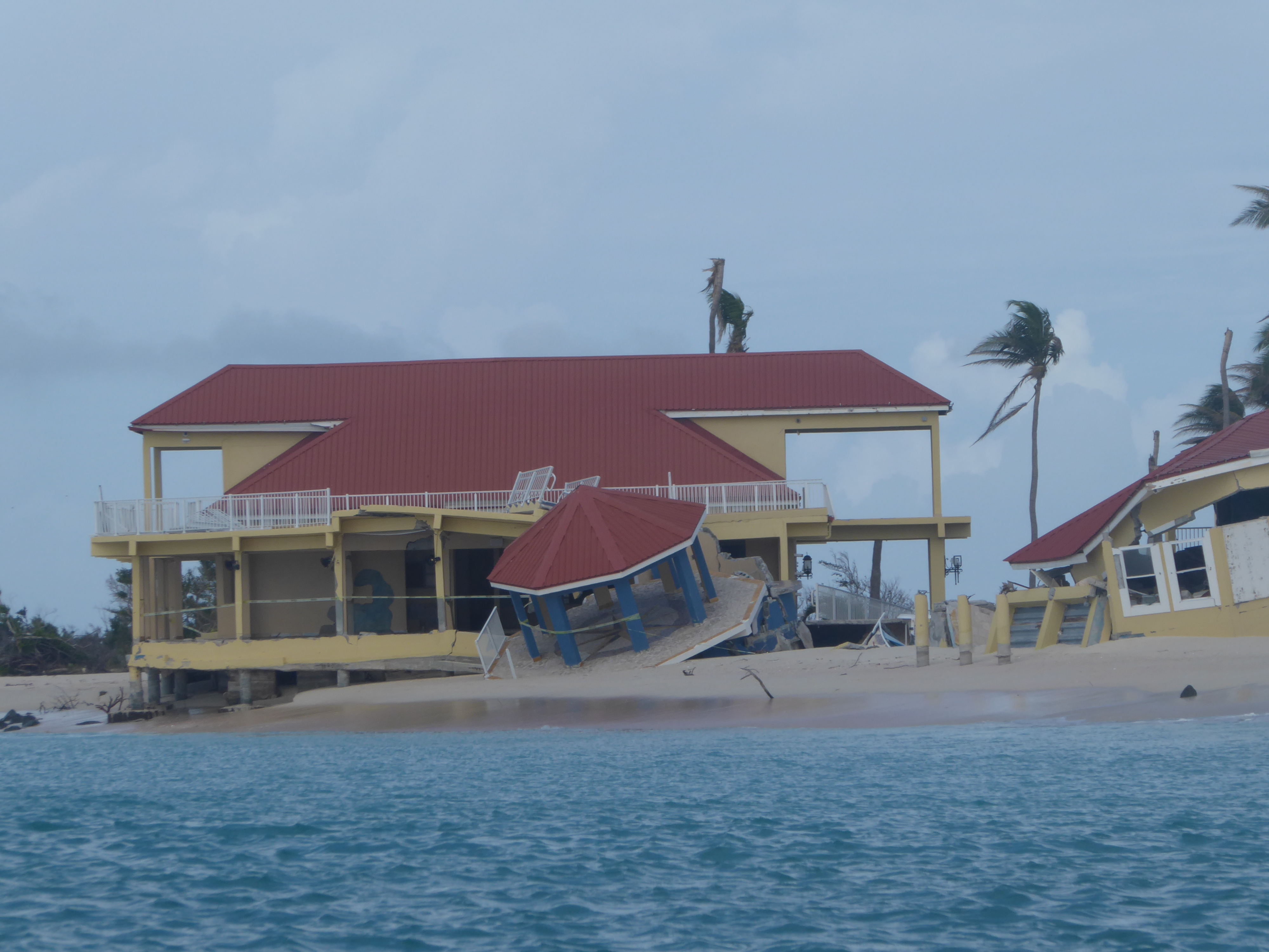
Lighthouse Resort
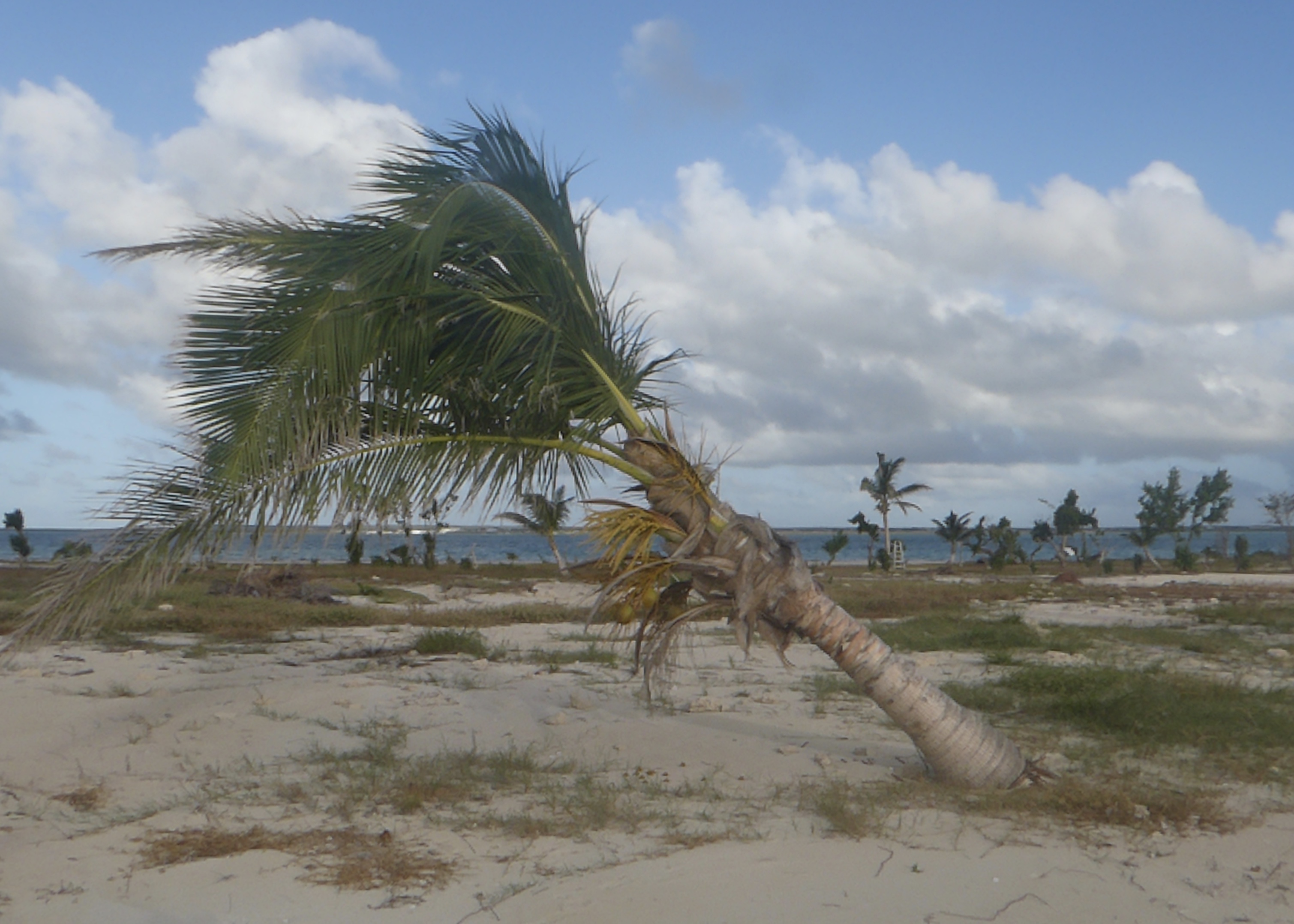
Palm trees bend with the wind
Lous Mouth (photo courtesy of GEMEAUX)
We dinghied through the breach and into the lagoon – once to explore the beach that once was the Outback, and the second time to motor across the lagoon into Codrington. We wondered about the two large white buildings we saw from the beach, but upon arriving, learned they were large tents set up by relief agencies Samaritan’s Purse and Food for the World/US AID. Each contains stockpiles of relief materials – food, water, tents, tarps, building supplies. Pallets of lumber and roofing material are stacked near the fish processing plant that now serves as headquarters and shelter.
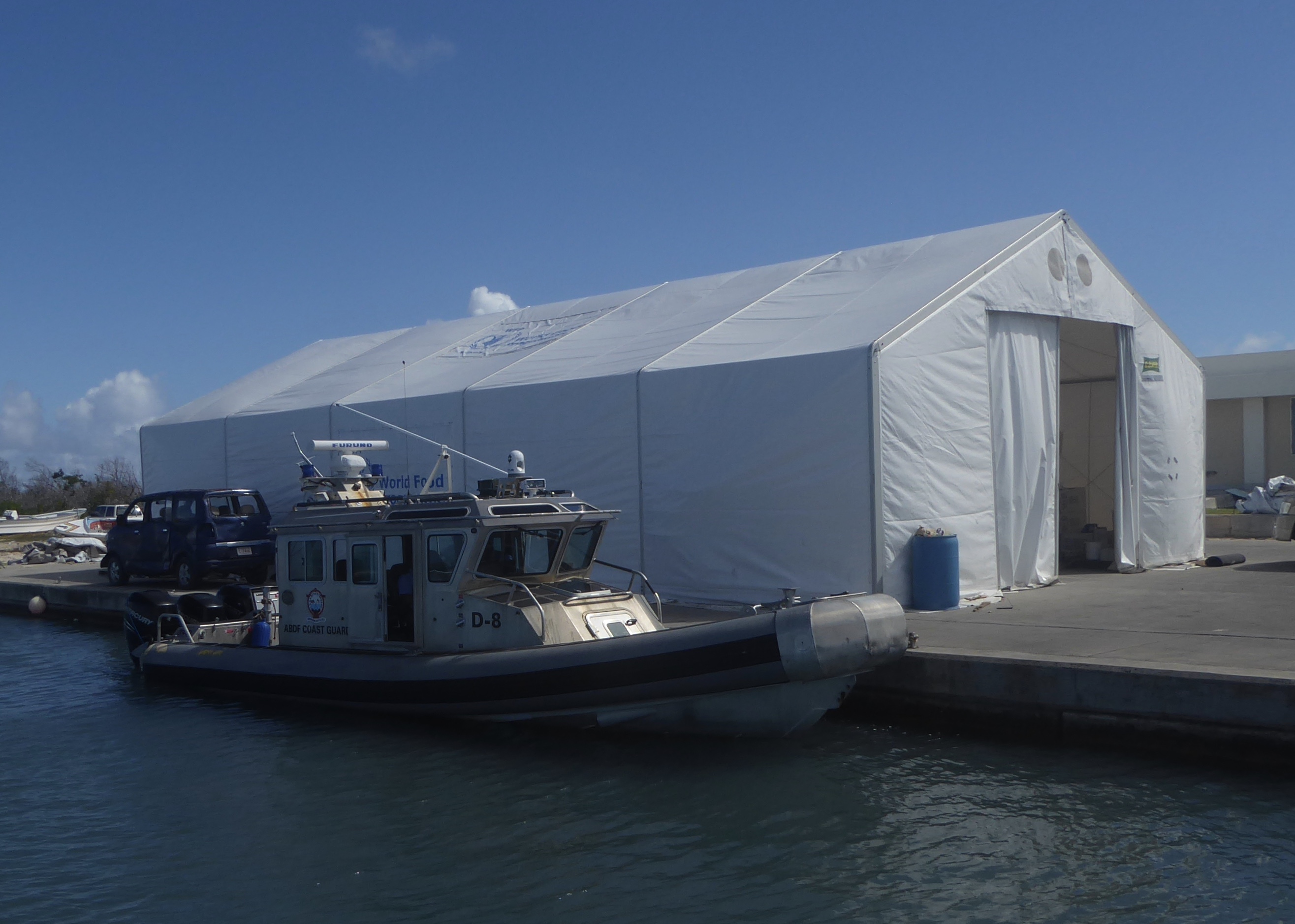
Relief headquarters
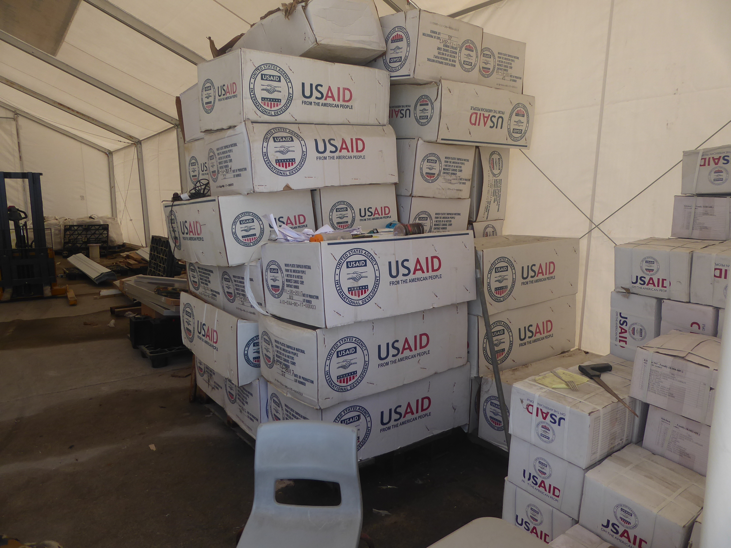
Relief supplies
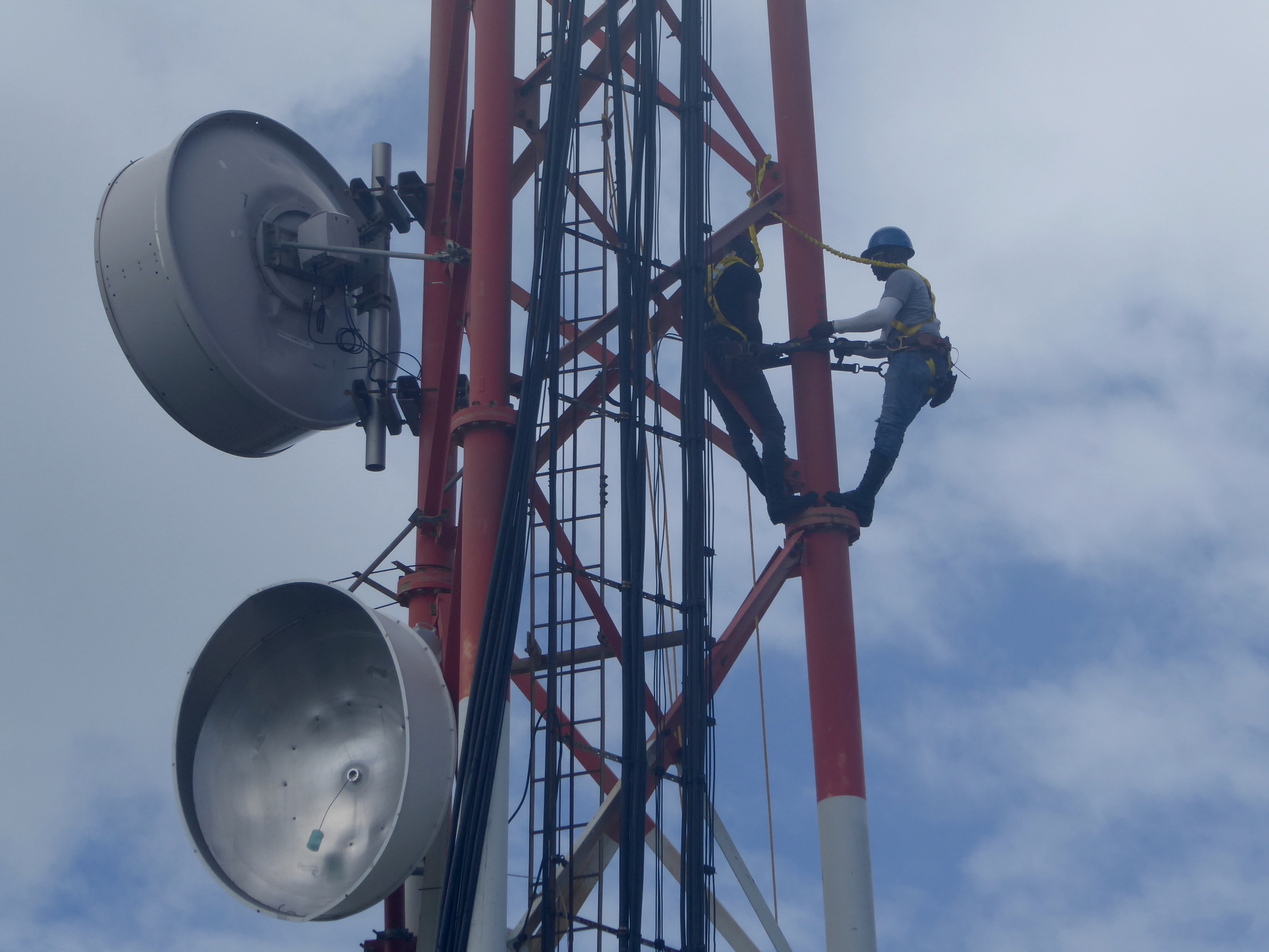
Restoring comms
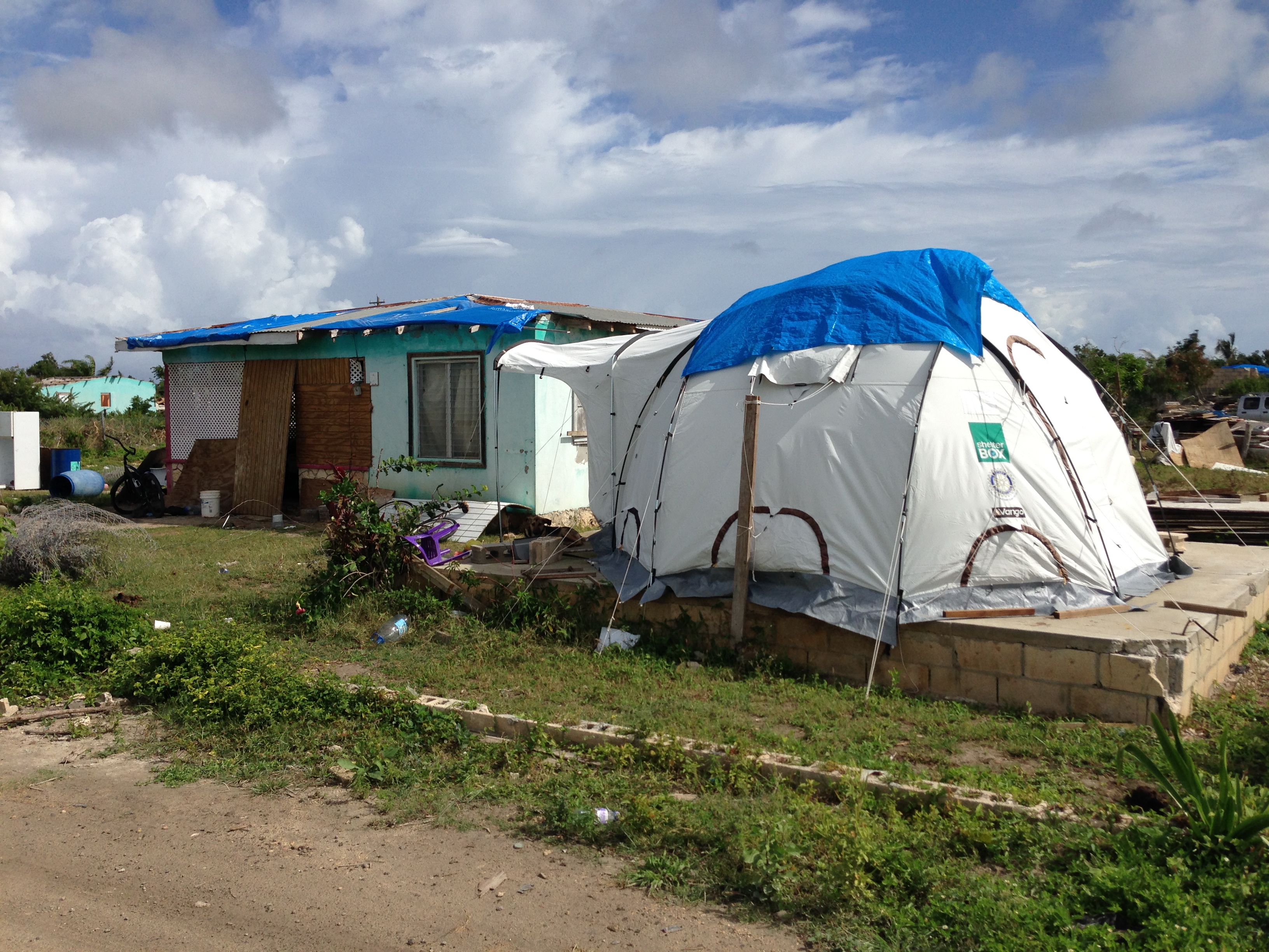
Tents for those rebuilding their homes
Residents are gradually making their way back to the island to rebuild their homes, businesses and lives. Adjacent to many roofless homes are igloo tents, where the homeowners live while they clear debris and rebuild their homes. Tarps provide shade and shelter – blue tarps carry the Samaritan’s Purse logo, and silver tarps are emblazoned with “US AID”. School has reconvened in the green-stone church with the blue tarp roof.
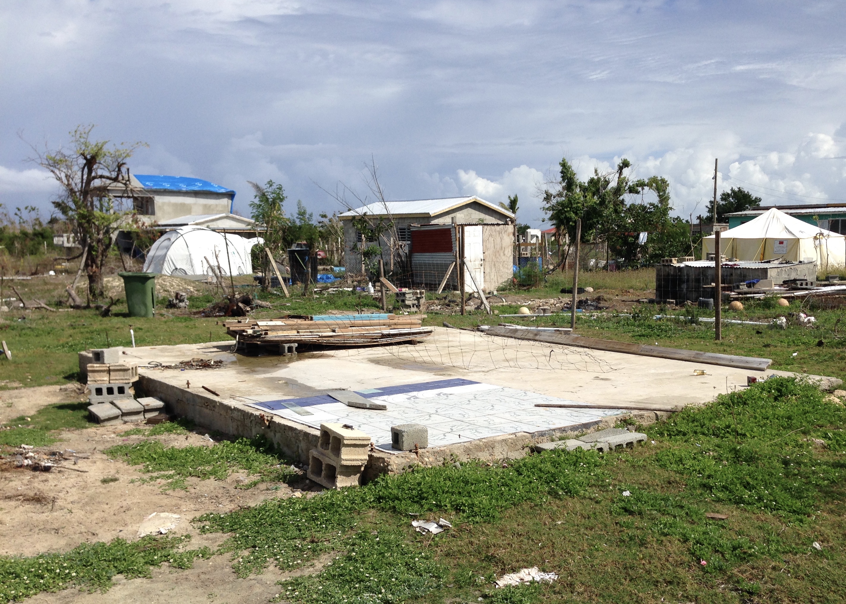
Nothing left but foundation
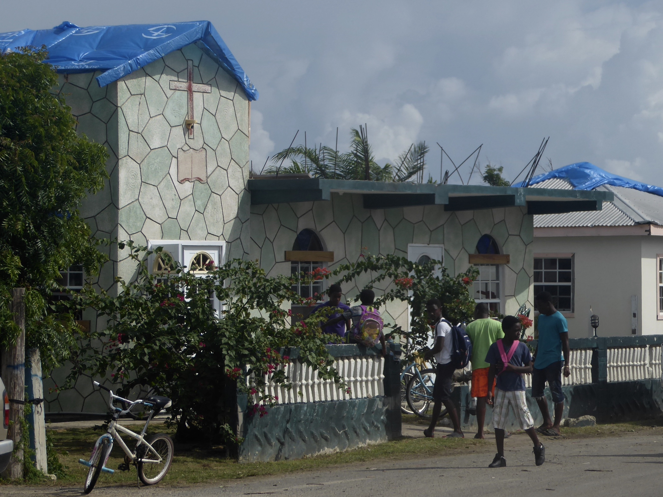
School is reopened in the church
Samaritan’s Purse provides two warm meals a day for residents working on their homes. A generator-powered pump extracts fresh water from an adjacent well; water is routed to a distribution site under “the brown tent”, allowing 8 people to fill their water jugs simultaneously. Generators were strategically located, several power lines restrung, and phone service is gradually being restored. We found horses and donkeys roaming freely in school grounds and homesteads.
While the news reports led us to believe we’d find rebellious, hostile islanders, it just wasn’t the case. As we walked through Codrington, the Barbudans were very friendly. They greeted us warmly, and were upbeat and optimistic about their progress in rebuilding.
On our third visit, we were able to tour the frigate bird rookery/sanctuary, based in the lagoon’s mangroves. Frigate birds feed primarily on flying fish, but the birds cannot dive or land on water – they must catch the fish while they are above the surface. Frigates are also known as “Man o’ War” birds, since they often chase down diving seabirds with captured fish in their talons. We frequently have frigate birds flying along as we sail – the boat’s bow wave flushes out the flying fish, and the frigate birds pounce.
John Levy has a taxi service, a boat, and a popular beach restaurant (covered with a Samaritan’s Purse tarp, but operating nonetheless) John can serve you lobster, or deliver a sack of live lobsters for your crew. He is also the only operating taxi driver with a VHF radio, which makes him the “go to” guy for cruisers wishing to get to town from Cocoa Point, or tour the frigate bird sanctuary. (Note: Digicel and FLOW worked in Codrington, but there was no FLOW service at Cocoa Point in Dec/Jan) John met us on the beach at Cocoa Point, and arranged for one of his sons to drive us to the dock at Codrington, where Captain Patrick ran the frigate tour.
Pat is an Antiguan who’s spent most of his life on Barbuda. He maintains Barbuda’s power plant, but is also a waterman. Pat’s sons were born on Barbuda, but they are not considered Barbudan. That’s important from a land perspective, as only Barbudans can own land in Barbuda. Pat clarified the communal ownership status, and indicated that Barbudans were “Tenants of the Crown” (as Mr Codrington was 4 centuries ago), not owners. Apparently, that’s an entirely different legal status from the practice of “land held in common by Barbudans.” He also offered another perspective on the proposed legislation allowing Barbudans to purchase their homestead for 1 ECD (about 38 cents US). While the fee is minimal, the transaction is key – the purchase would allow the Barbudan to acquire freehold title to a property, which would allow them to get a bank loan for improvements. It’s more than a way to motivate Barbudans to rebuild – it’s designed to facilitate rebuilding with funds.
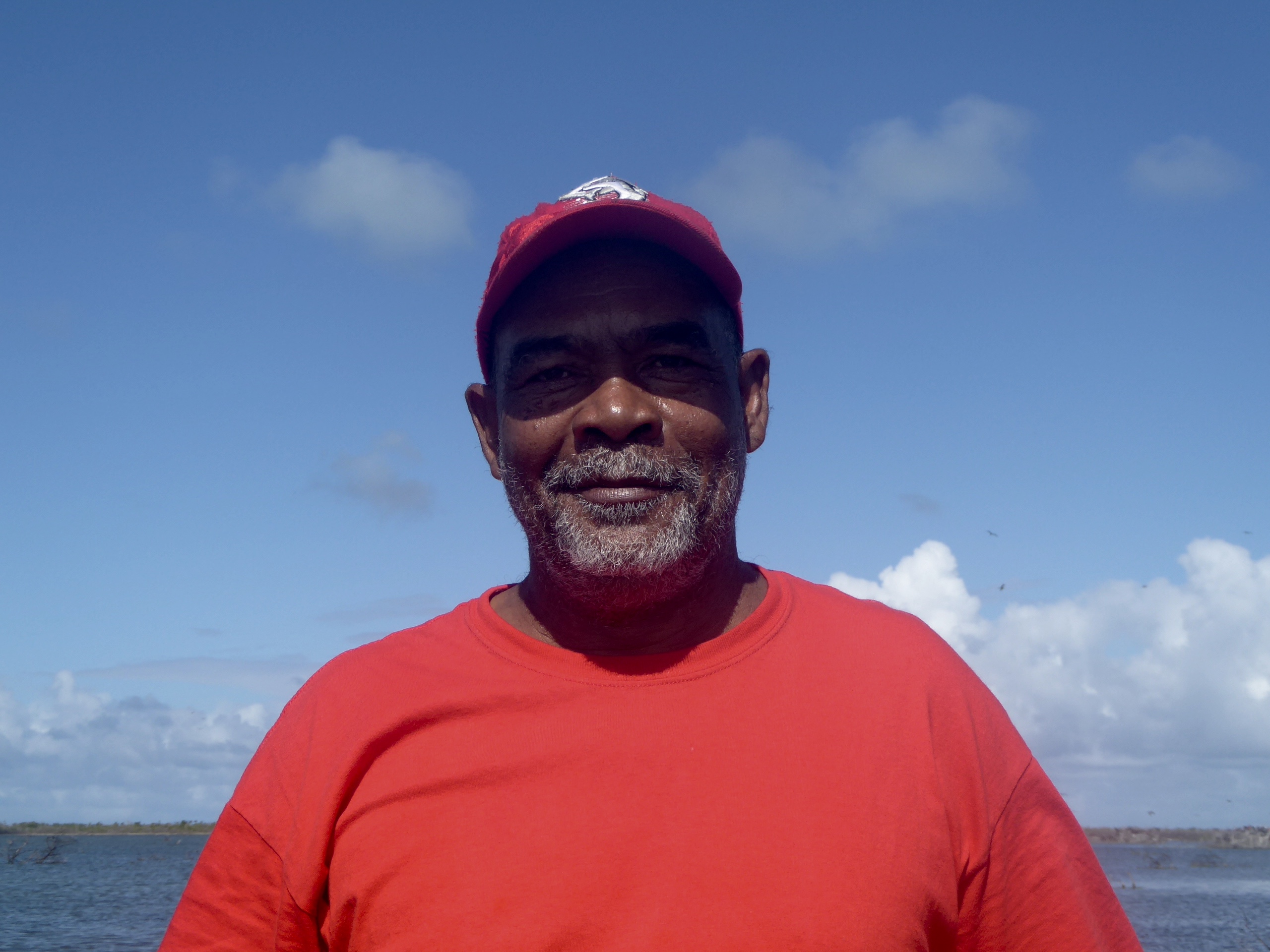
Captain Pat offers some perspective
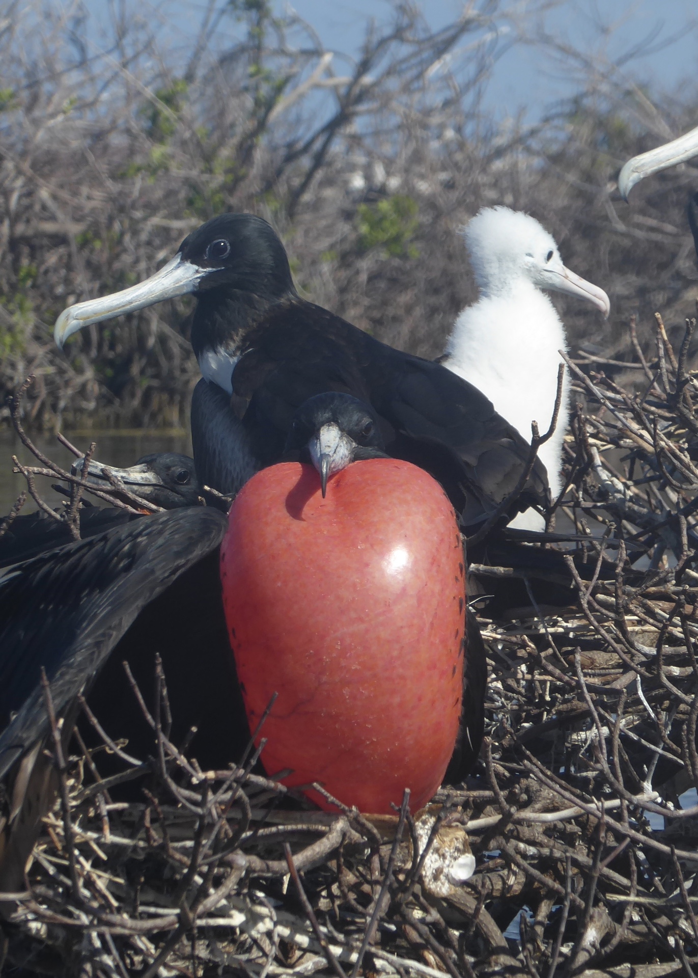
Hopeful male, female & chick
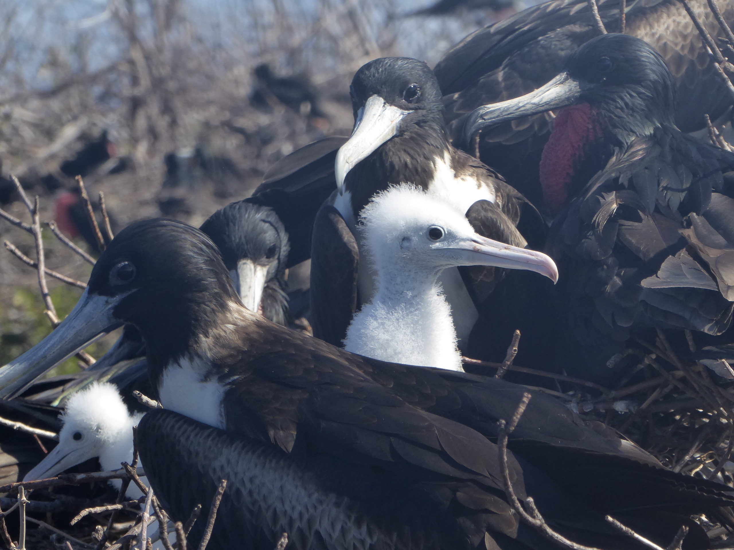
New chick
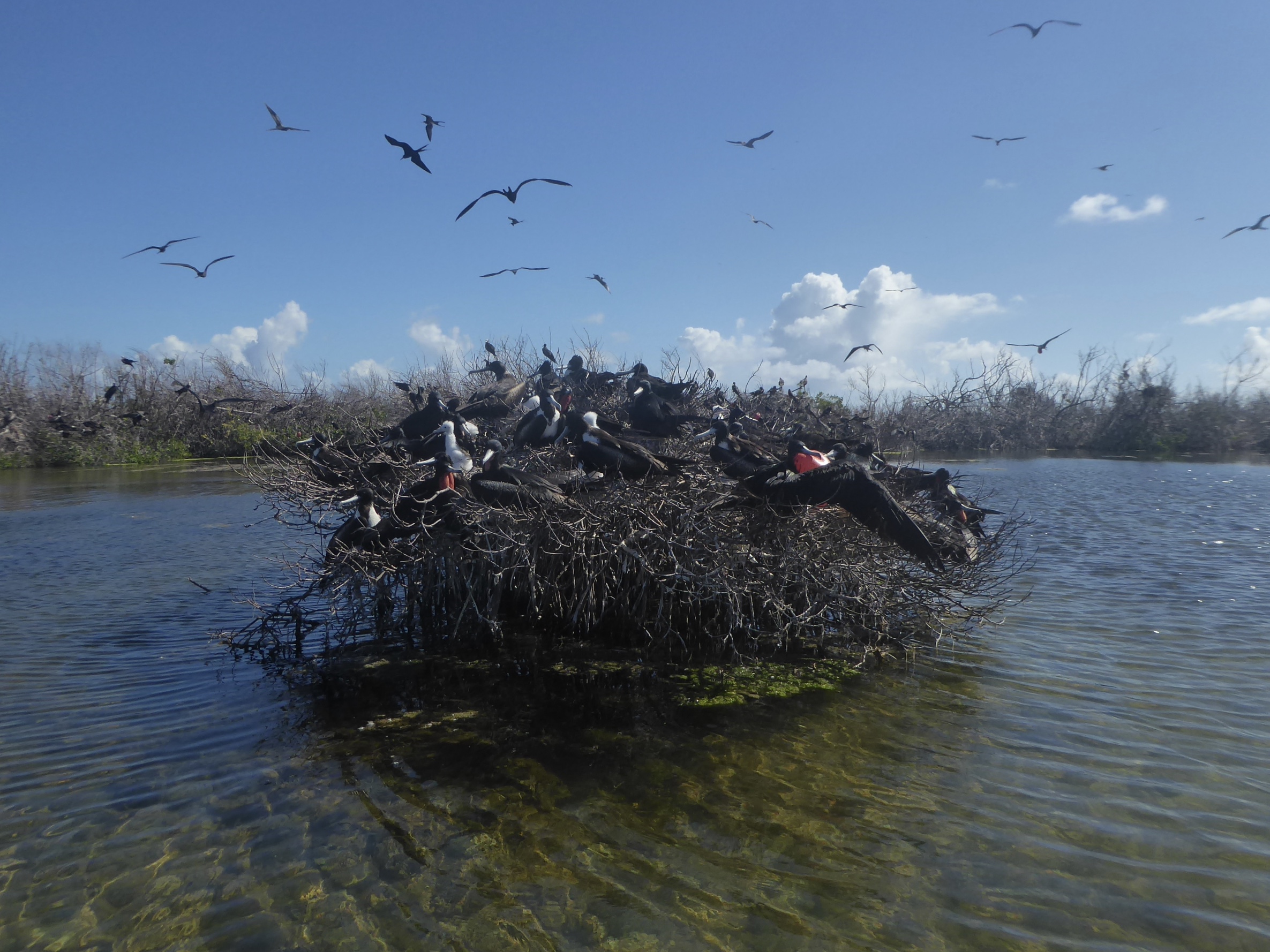
Mangrove stumps
Back to the frigate birds….. having seen the sanctuary twice before, I was eager to see what may have changed. Thankfully, the frigate birds are in fine form, and fully engaged in the mating season. Males beat their puffed out red bladders to attract a female mate. Several fuzzy white chicks have already been born, and sit comically in the nest while their parents watch over. There are far fewer frigate birds this year, but those remaining look very healthy. Visually, the most dramatic change was the mangroves in which the birds nest. Normally lush and green, the mangroves suffered greatly from the hurricane, and were little more than brown clumps. Pat showed us “Man ‘o War” island, where the frigate colony used to live before Hurricane Donna struck in 1960. Afterward, the frigate colony moved to it’s current mangrove site, a mile or so north. Will they move again, or will the mangroves regenerate? Nobody was able to tell us how the frigate birds survived the hurricane, which occurred just as the males were returning for the mating season. Presumably they flew away (perhaps staying airborne) and returned to their mangroves after the storm passed.
Perhaps we can draw some lessons from the frigate birds. They don’t let politics, privilege, land rights or lawsuits get in their way. They survived the storm, returned to their decimated homes, rebuilt their nests, and went about the business of living and repopulating. It seems that’s what many Barbudans are doing, as well. Please go visit, lend support, and help Barbudans recover their homes and livelihoods.
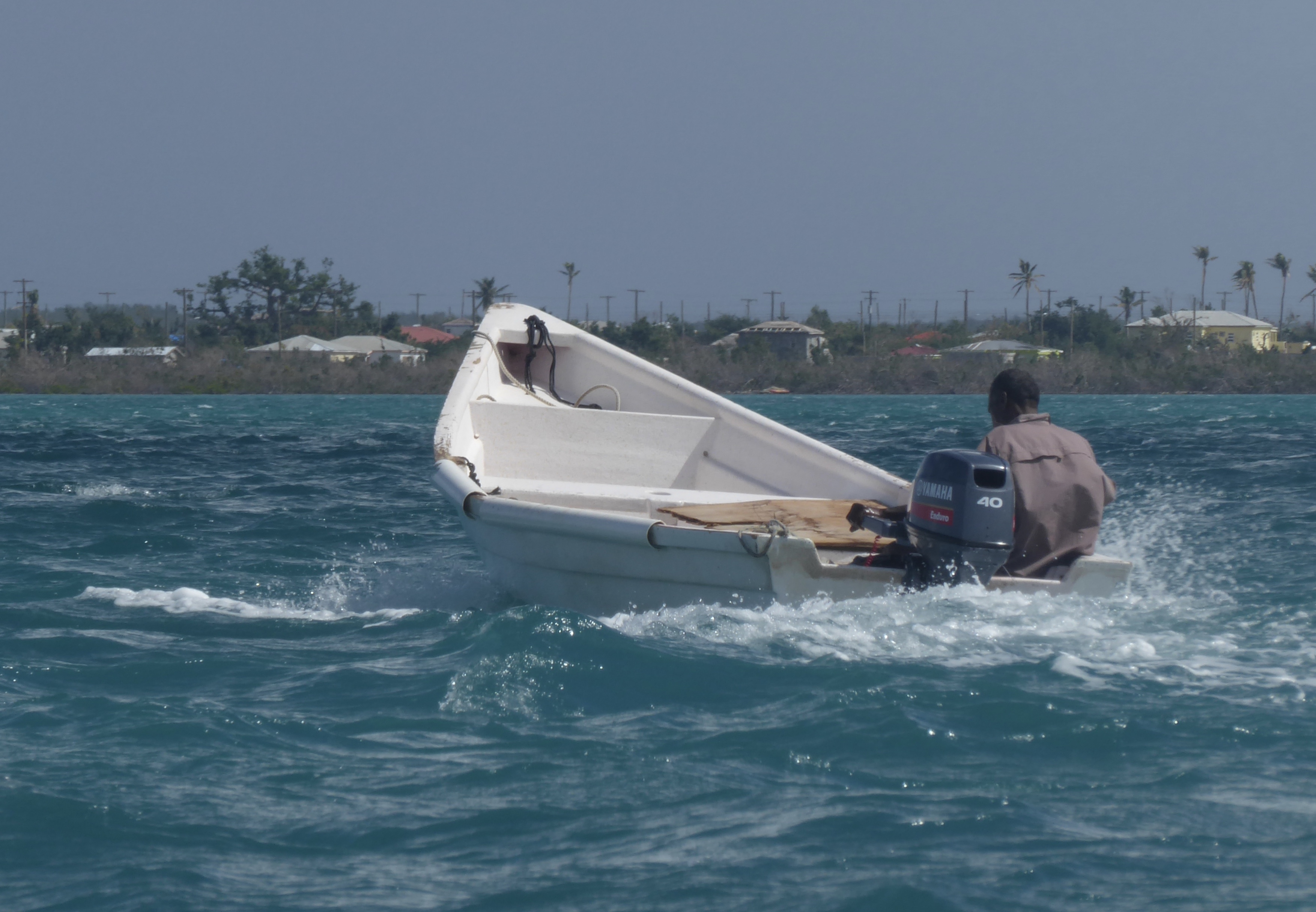
Fishing again
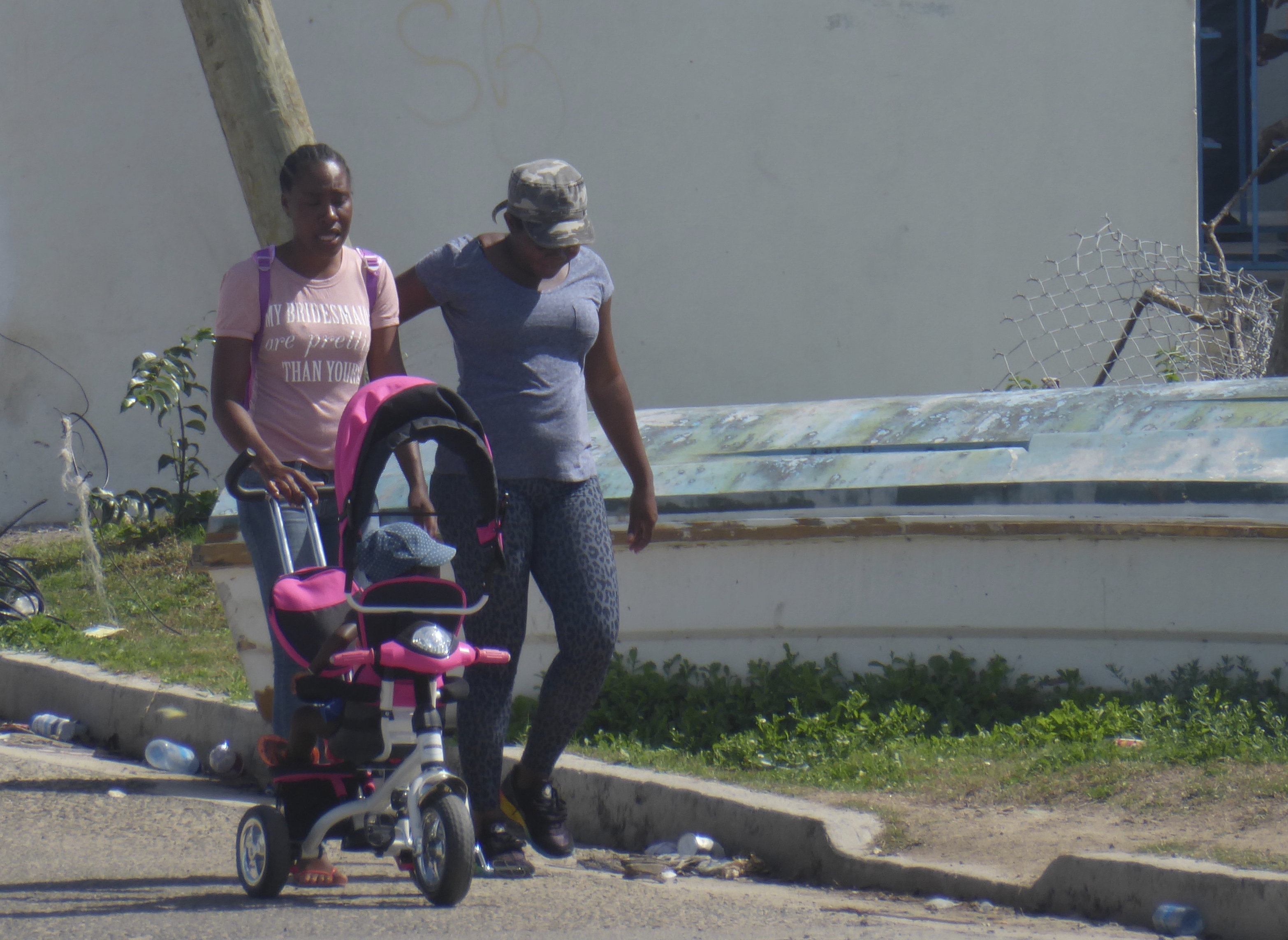
Life goes on in Barbuda
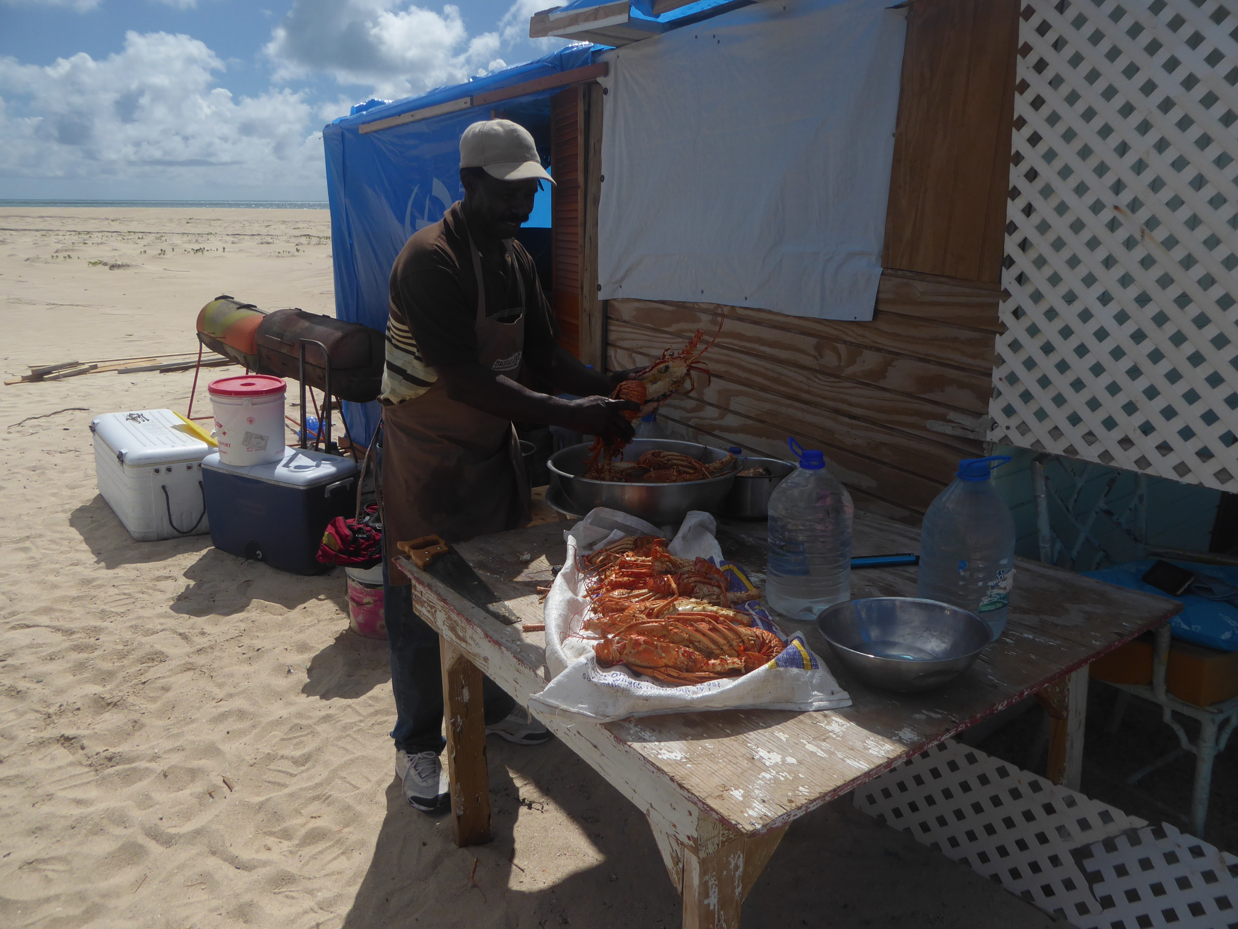
John has reopened his Pink Beach Restaurant
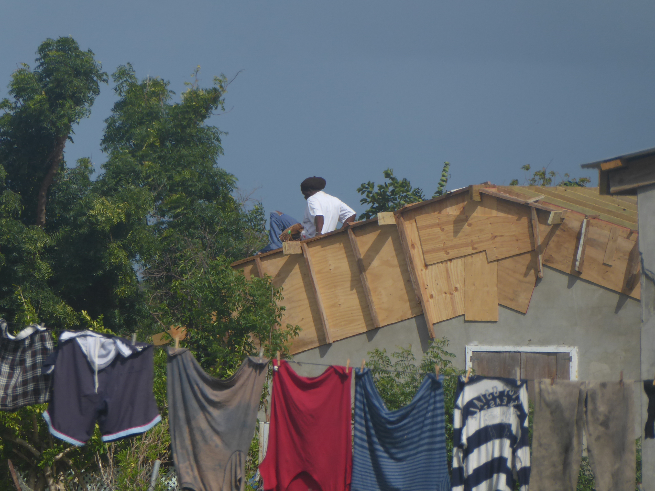
Getting the roof on
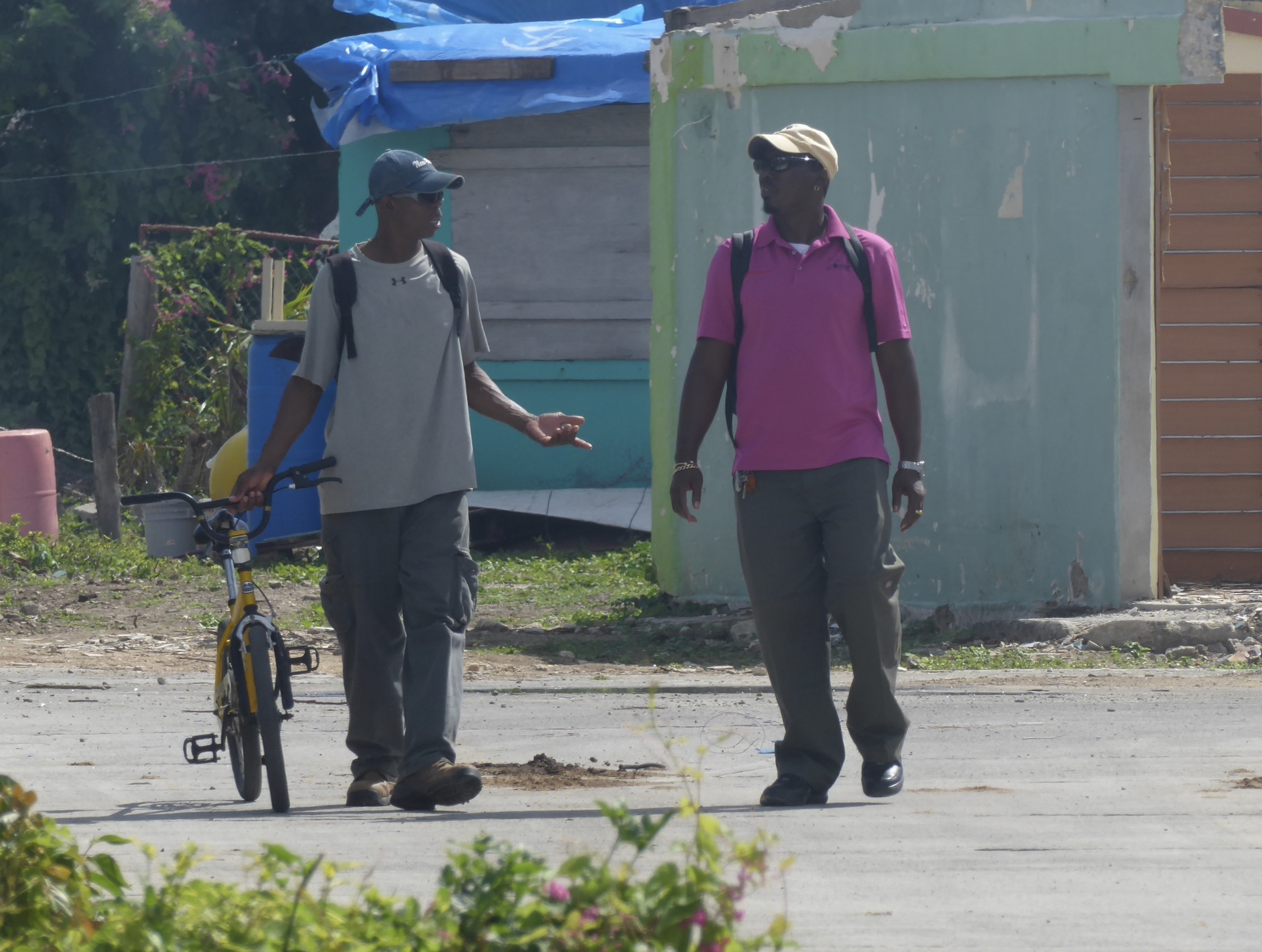
Making it work